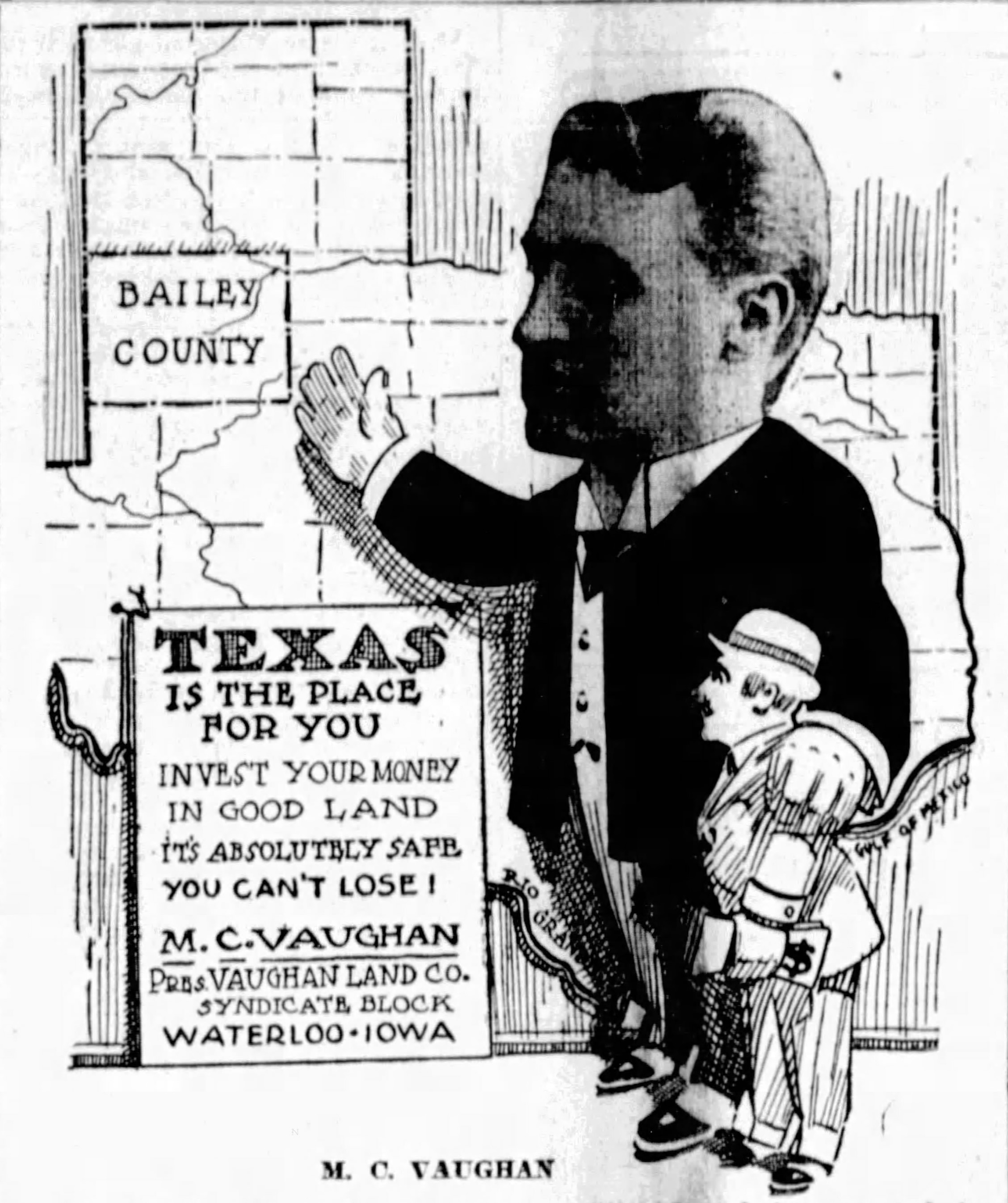
The settlement of the Llano Estacado during the closing decades of the 1800s and first decades of the 1900s entails the narrative of many facets of contemporary American life. Agriculture remained essential for national growth, railroads still reigned supreme for the transportation needs of its populace, and the abundance of cheap land in the undeveloped counties of Texas and elsewhere ignited the dreams and aspirations of those who aimed to harness its bounty. Marketing and selling this cheap land did not present a new venture when Matthew Charles (M.C.) Vaughan of Waterloo, Iowa, came to Texas in 1907. However, Vaughan and his contemporaries employed new advertising techniques to promote land sales that simultaneously padded regional climatological statistics and overstated the capability of the land for agriculture compared to its true value. Land prices surged as these promotions proliferated. The price of Bailey County land jumped from fifty cents per acre in 1882 to one dollar in 1900, but the most significant jump occurred over the next decade. The Vaughan Land Company advertised and sold land for twenty dollars or higher per acre in 1909, a nearly 4,000% increase in three decades.1 Natural and manipulated factors drove this growth as new settlers flooded the area, but what makes Bailey County's land rush and early development unique?2 This study aims to discuss the early history of Bailey County land use and development, including that of Virginia City, Texas, and the abrupt end to the Vaughan Land Company's colonization of west-central Bailey County.
The 1900 United States census recorded four residents in Bailey County. George G. Smith, a forty seven-year-old English-born cook from Palo Pinto County, presumably worked for one of the ranches in the county prior to major development. His wife and two children represented the remaining three residents. While the Smith family returned to Oran in Palo Pinto County later in 1900, they constitute the first recorded residents of the county during a period when census tabulation relied upon enumerator knowledge of the region to document rural population centers.3 Previous censuses recorded no permanent population in Bailey County, although maps from the Texas General Land Office indicate a ranching presence in the county as early as 1882. Ranches labeled as the Causey & Arnold Ranch and the Carter Brothers Ranch existed in the northern portion of the county along the Blackwater Draw at Wolf Lakes and Agua Negra, respectively.4
The earliest recorded land transfer in the county occurred in 1882 when brothers Leon, Hyman, and Sylvain Blum acquired nearly 150,000 acres of land in Bailey County for fifty cents per acre from the State of Texas.5 An act passed by the 16th Texas Legislature in 1879 provided for the disbursement of the unappropriated public lands in the state at fifty cents per acre enabling this substantial land acquisition comprising more than twenty five percent of the county and its 529,000 acres.6 Founded in Galveston in June 1882 by Leon and Hyman Blum, the Leon and H. Blum Land Company actively traded land across the state of Texas selling large and small tracts in over 150 counties.7 The Blum family came to the United States from the Alsace region of France during the mid-19th century. They became the largest wholesale dry and fancy goods dealers in the state doing more than 1 million dollars of business per year by the 1870s and more than 5 million dollars per year by 1900.8 The mercantile business struggled after a series of financial debacles in the 1890s enhanced by the Panic of 1893 before ultimately folding in 1908. In the decade prior to financial struggle, the brothers entered real estate in 1882 utilizing their earned business income to invest in Texas land as a diversified business venture to grow their holdings.9
Leon and Hyman Blum submitted Applications for Purchase for each individual 640-acre section to the Texas General Land Office on March 14, 1882, as they looked to accumulate their land holdings in Bailey County. Two months later, the GLO dispatched land surveyors to Bailey County to evaluate and survey the expanse near modern Coyote Lake and Monument Lake. During May and June 1882, Philip Toberman, deputy surveyor of the Baylor Land District, along with chain carriers A. M. Sullivan and William Walden laid out the neatly arranged area and produced field notes with precise dimensions of each section. They created a grid-like property 23 miles long from north to south and between 11 and 13 miles wide from east to west that directly abutted the New Mexico border. The Blums paid $75,000 dollars to the Texas Treasurer's Office in cash for the 150,000 acres in October 1882.10
The Blums filed 289 applications in the March 1882 submission comprising three blocks of land known as Melven, Blum, and Blum blocks A, B, and C. The blocks today total only 197 sections, however.11 The State rejected and chose not to patent a portion of the applications as they existed across the border in New Mexico. A Capitol Land Reservation surveying error eliminated more sections. This error dated to 1880 and misaligned the bottom tier of Capitol leagues in Bailey County. In platting the connecting line between Capitol Land Reservation blocks in neighboring Lamb County divided by the unwanted span of sandhills that traverse the county, contracted surveyor Joseph Theodore ( J.T.) Munson erred by connecting League 633 south of the sandhills to League 617 rather than League 618 to the south.12 In neighboring Bailey County, this error mistakenly created space for a league that could not fit within the constraints of the Capitol Land Reservation's western boundary with the State of New Mexico boundary. The surveyors of the Blum property utilized the southwest corner of Capitol League 628 as their origin point in 1882, but later map and boundary updates moved this erroneous point east to its correct and current location. This correction eliminated a number of sections as they too existed in New Mexico with the updated coordinates of the southwest corner of league 628.13 In the latter part of 1882, Leon Blum separately applied for twelve sections on the eastern boundary of blocks A, B, and C. Known later as Block F, this encompassed the entirety of Monument Lake and became another tract of land added to their holdings.
Prior to the Blum's ownership which began in 1882, the land featured interwoven cattle trails laid over the old Fort Sumner Trail, Mackenzie Trail, and the earlier Comanche Trail as the routes aided travelers move from New Mexico into central Texas and beyond. One trail extended from near Fort Sumner along the Pecos River to the Lubbock vicinity crossing the Llano Estacado toward locations known as Punta de Agua and Canon del Rescate. This trail bisected the Blum lands in Bailey County from northwest to southeast.14 Bailey County maps from the late 1800s and early 1900s depict these trails and further indicate that the trail splits near modern Arch Lake at a point within the Blum lands. Later aerial photography from the mid-20th century corroborates this.15 The easterly branch spans from Arch Lake to Coyote Lake before joining the route of the Blackwater Draw to the east. This segment individually assumed the Mackenzie Trail moniker denoting Ranald Slidell Mackenzie's 1872 movements during the runup to the Red River War as he trailed the Comanche toward Portales Spring and Fort Sumner.16 The southeasterly trail diverges southeast from Arch Lake toward Monument Lake, and on to the several lakes at the modern Muleshoe National Wildlife Refuge, Casas Amarillas, and Punta de Agua.17 The trails meandered and featured innumerable branches, but both offered routes across the Llano Estacado with accessible and consistent water present at the springs of the aforementioned lakes which often featured standing water during wet periods.18
As early as 1882, intermittent ranching operations existed on and around the eventual Blum property utilizing the plentiful extant water sources such as the Blackwater Draw, Coyote Lake, and Monument Lake. The aforementioned Carter Brother's presence on the Blackwater Draw is indicated on an 1882 Capitol Land Reservation map just outside the northern boundary of the Blum land.19 James W. Carter trailed cattle from the Pecos River to the Blackwater Draw and its eponymous feature "Agua Negra" on his trek to Kansas City to transfer his cattle to a northern ranchman.20 Carter's presence in the vicinity must have been more than transitory owing to its indication on an 1882 map of the entire Texas Panhandle. Carter became one of the first permanent settlers in adjacent Castro County establishing his Seven-Up ranch on 53,000 acres there in subsequent years.21 Further east on the Blackwater Draw, Thomas L. "George" Causey established a short-lived ranching camp at Wolf and Sulphur lakes near modern Muleshoe.22 To illustrate Bailey County's lack of development through the first half of the 1880s, tax assessments for Bailey County show no assessed taxable values in Bailey County in 1881, but subsequent 1885 and 1889 reports show $10,475 and $105,800 assessed values respectively.23 It is likely that a majority of these assessments sourced from XIT Ranch operations in the county, which began around 1885 or 1886 in the XIT's Blackwater Pasture in the northern area of the county.
Although the southern east-west XIT Ranch fence line extended to northern Bailey County, the establishment of the VVN Ranch on the Blum property marked the first permanent ranching effort in Bailey County, in 1891. The VVN cattle brand originated in Fremont and Park counties, Colorado, as brothers Charles Bishop (C.B.) and John Arthur ( J.A.) Eddy operated large cattle operations on the northwest slope of Black Mountain in Park County, Colorado, utilizing the VVN brand for their cattle. Both men became prominent stockmen in Colorado with J.A. acting as a founding member of the South Park Cattle Growers Association.24 In the early 1880s, the brothers began trailing cattle from the Pecos River Valley in New Mexico north to their Colorado range.25 They would eventually settle near Carlsbad, New Mexico, lending their name to the county in which Carlsbad would rise. In 1884, the Eddy brothers partnered with James and George Bissell and others to form the Eddy & Bissell Live Stock Company.26 The partnership maintained ranches in both Colorado and New Mexico throughout the remainder of the 1880s and into the 1890s using the VVN brand, but they refocused their growth to the plains of Texas and Bailey County in 1891.27 They employed David Franklin White, a noted ranchman from the Abilene region, to organize their Bailey County venture while leasing the Blum land for their cattle. The Eddy & Bissell Livestock Company operated the ranch in Bailey County until 1896 when they sold their interests to William J. Good and Sons of Quanah, Texas, and Hezekiah G. Williams and Thomas Jefferson Moore both of Llano, Texas. This entity continued using the VVN brand during their tenure. They also constructed a main headquarters for their ranch on the property in the sandhills north of Coyote Lake (Fig. 2).28
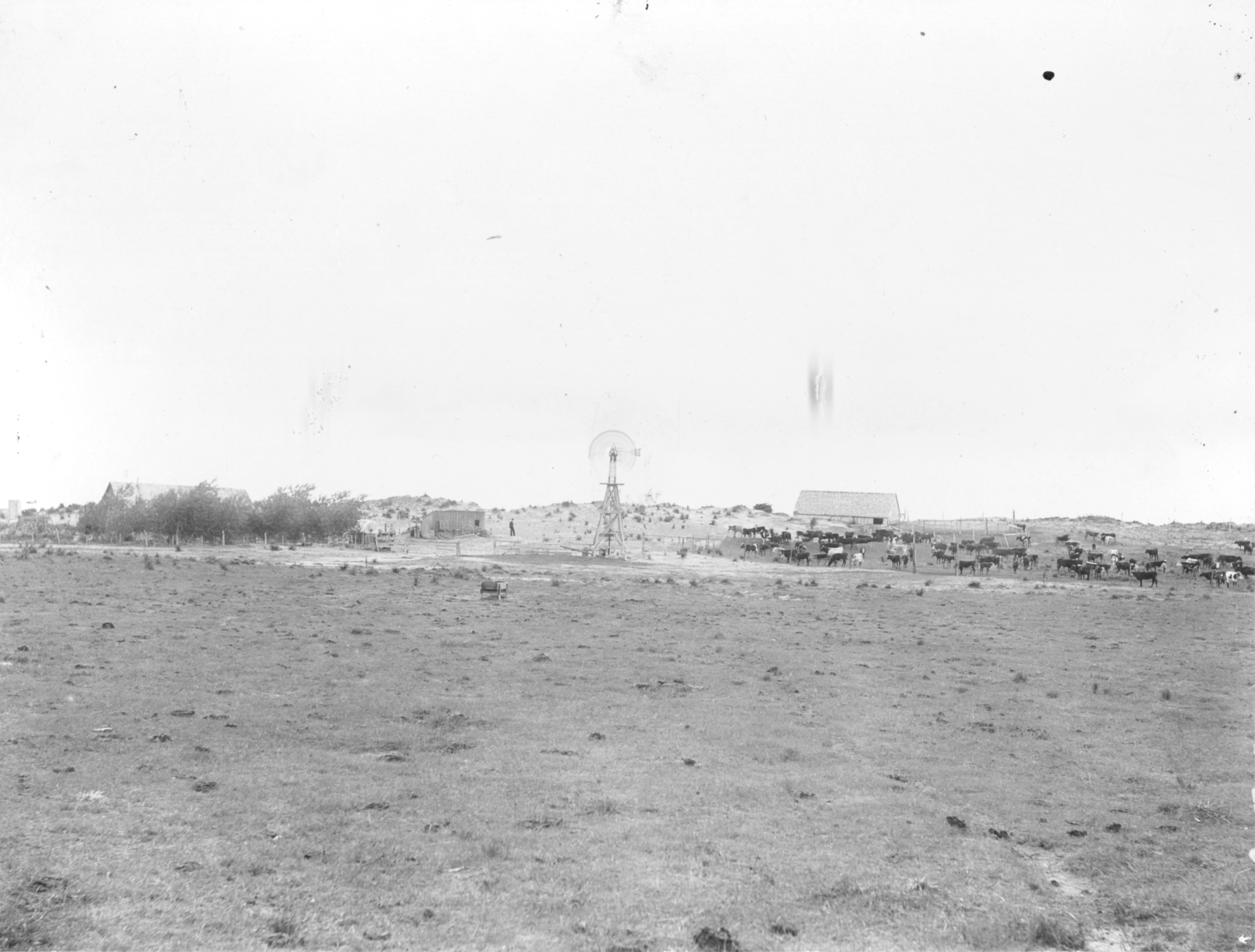
Courtesy of the National Cowboy & Western Heritage Museum
By the late 1890s, the Galveston-based Leon & H. Blum mercantile firm experienced a downturn in profitability that affected the separate land company's viability. In March 1896, the Blums issued a notice of assignment informing the public of their divestment from the mercantile division with reported debts and liabilities totaling more than two million dollars.29 Simeon Pierre Mistrot of the Mistrot Brothers mercantile firm of Houston purchased the Blum's mercantile holdings for sixty six cents on the dollar in May 1896. The Mistrot Brothers transferred their existing business from Houston to Galveston and moved into the former Blum building.30 Although the separate land company did not directly suffer from the mercantile business's failure, the forward direction of the land company greatly weakened with the failure of the latter entity. The land company began downsizing its operations shortly after, but W.J. and Wallace Good continued to lease the land in Bailey County, maintaining their cattle operation as the Blum company struggled.
In May 1899, the Leon & H. Blum Land Company offered for sale the entire VVN Ranch consisting of more than 158,000 acres.31 Notices advertising the land appeared in newspapers across the state, but the land did not sell for nearly a year before James Robertson ( J.R.) Couts of Weatherford purchased the Blum land for one dollar per acre in 1900. Along with this land purchase, Couts also purchased the livestock owned by W.J. and Wallace Good held on the property at the time.32 The Goods maintained an operation in Bailey County after they transferred their operation to an adjacent area to the east later known as the 69 Ranch.33 Couts, a wealthy Weatherford and Parker County banker, formed the Bailey County Cattle Company and stocked cattle on this land until his death in 1904.34 Couts visited the ranch once during the summer months of 1902.35 James Albert ( J.A.) Oden, a cowboy on the nearby XIT Ranch and previously of the IOA Ranch, served as a foreman of the VVN Ranch prior to and during Couts' ownership.36 Oden became an elected commissioner of Castro County during this period when unorganized Bailey County administratively attached to Castro County for official purposes. Oden later served as vice president of the Black Water Valley State Bank in Muleshoe shortly after the bank's founding in 1914.37
Couts's ownership represents the last period during which the original Blum property existed as a singular piece of land totaling nearly 160,000 acres. Following Couts' death, the estate dispensed the southern half of the VVN Ranch in October 1905 to William Hurt of Lynchburg, Virginia, for $2.25 per acre, more than double what Couts had paid for the land in 1900.38 The northern half of the property remained active as the VVN Ranch. William Sloan Simpson, Harvard graduate and son of Stock Raisers Association of Northwestern Texas founder John Nicholas Simpson, managed the ranch alongside Oden for a short period of time in the early 20th century. Simpson departed the ranch in 1907 and became a postmaster in Dallas County.39 Simpson notably fought in the Spanish- American war as a Rough Rider with Theodore Roosevelt. Following the 1904 presidential election, Simpson corresponded with Roosevelt from the VVN Ranch in Bailey County informing him that all but one of the citizens of Bailey County voted for Roosevelt in that election.40 Banker and owner of Amarillo's First National Bank, Wiley Holder (W.H.) Fuqua, purchased the northern portion of the VVN Ranch in May 1906. The Fuqua Land and Cattle Company operated the ranch through 1936 when a New York-based mortgage firm assumed control from the company when Fuqua failed to pay a 1932 Reconstruction Finance Corporation loan that placed the Bailey County land as security for the $1,800,000 agreement.41 John Lourie ( J.L.) Birdwell purchased the VVN Ranch in January 1948 after leasing the land from the West Texas Mortgage and Loan Company for a number of years prior. The Birdwell family remain active ranchers on a portion of the original VVN property in 2020s.42
The southern half of the former VVN Ranch became the focus of large- scale colonization efforts beginning shortly after William Hurt purchased more than 80,000 acres of the ranch in 1905. Hurt sold the land to William Harvey (W.H.) Garrett and other associates of Portales, New Mexico, at $4 per acre in December 1906, earning a profit of more than $130,000 just fourteen months after his purchase.43 Just as quickly as Garrett and his associates purchased the land for $4 per acre, they sold it to a Minneapolis- based colonization company for $5 per acre just days after the previous deal closed.44 This company, the Texas and Southwest Colonization Company (Fig. 3), originated as a subsidiary of the O.W. Kerr Land Company of Minneapolis, Minnesota, with the assistance of other land companies such
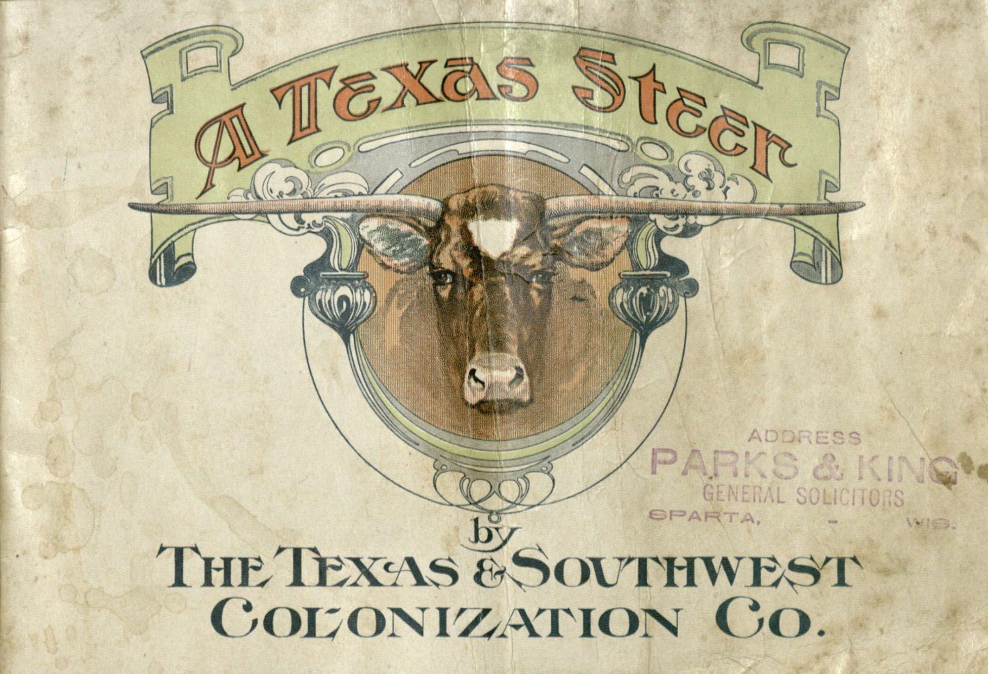
Courtesy of the Beinecke Library, Yale University
as the American-Canadian Land Company, the Minnesota and Western Land Company, and the Sulflow and Dredge Company, among others. Edward Everett (E.E.) MacGill represented the new company in Fort Worth during negotiations for the purchase. MacGill refused a subsequent offer from an eager land seeker that would have afforded the new company an immediate $68,000 profit, choosing instead to proceed with plans to sell the land in smaller tracts.45 With capital totaling $500,000, the company began advertising the Bailey County tracts within a week of the acquisition. The first excursion that brought prospective buyers to inspect the property arrived during the first week of January 1907 led by Gardner H. Porter, second vice president of the O.W. Kerr Land Company.46
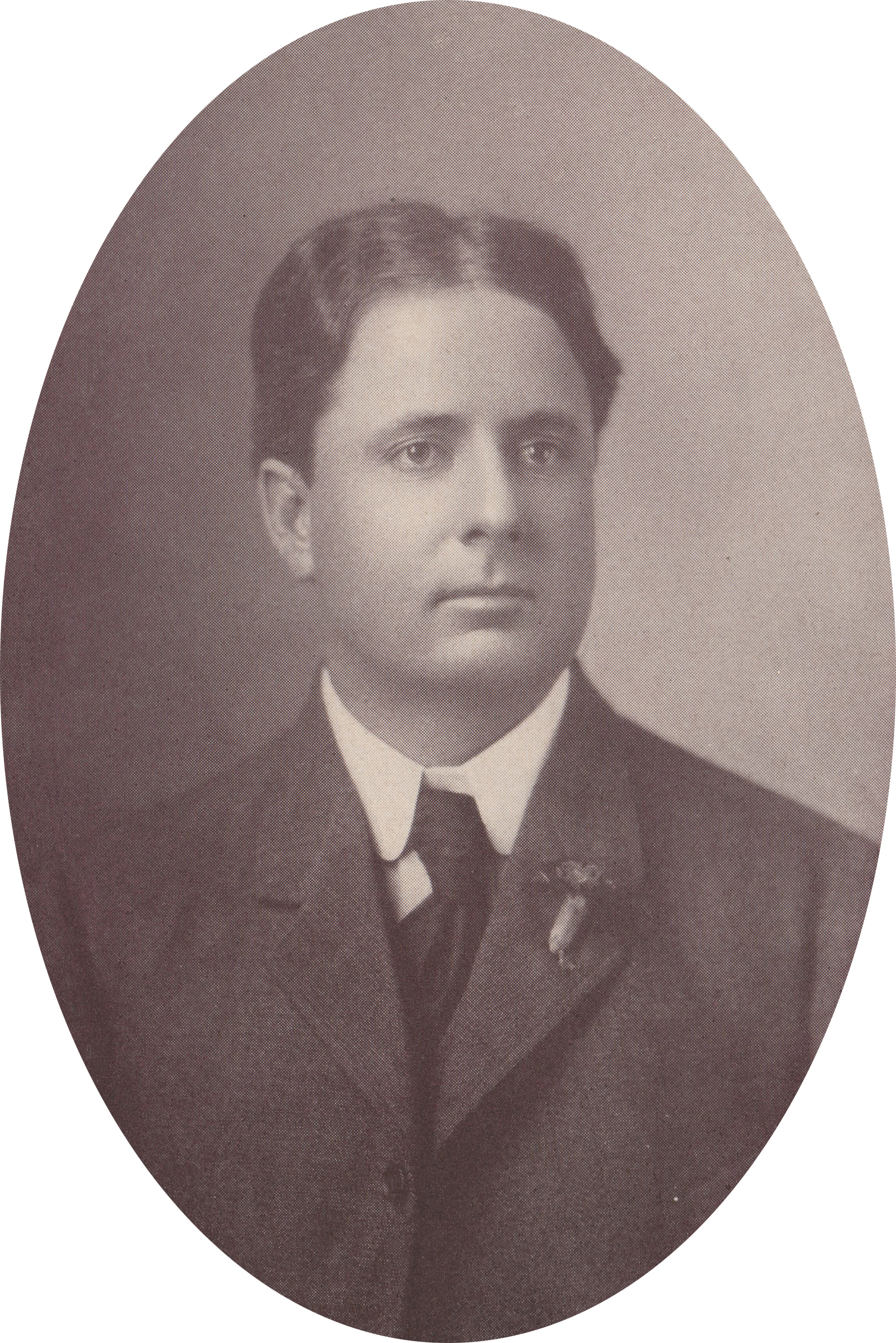
Courtesy of Austin Allison
Although known under both company names, the initial excursions chiefly emanated from the O.W. Kerr Land Company's orchestration. Named for founder Oscar W. Kerr (Fig. 4), the eponymous company developed in 1897 as a collection agency in Cooperstown, North Dakota, that transitioned into a land and real estate company in succeeding years.47 With an existing organized effort that primarily focused on the northern United States and southern Canada, the O.W. Kerr Land Company sent field salesman T.S. McKenzie to Portales, New Mexico, to establish a headquarters from which they would lead excursions to Bailey County. McKenzie opened their Portales office in the Vendome Hotel annex by January 12, 1907. He also established a temporary camp capable of supporting 30 to 40 excursionists on the Texas land that same week near Monument Lake at the eastern edge of the property.48 With the ultimate goal of establishing a sustainable community, the company founded a town called McKenzie on the property in late January 1907. The promoters contracted with the Maxwell & Williams carpentry firm of Portales to construct a two-story hotel on the property to accommodate incoming visitors.49
The company ran twice-a-month excursions utilizing private railroad cars that brought prospective buyers and land agents from Minnesota, Iowa, and other midwestern states to Portales charging as little as $20 for roundtrip travel accommodations depending on origin point. Largely seeking agents to sell land to individuals, the Texas and Southwest Colonization Company published advertisements seeking established agents who possessed experience selling land. One long-running advertisement asked, "Can you sell one section of land a month? If you can, you can handle this deal. If you cannot, you ought to get out of the land business."50 The Gesman Brothers firm of Pella and Oskaloosa, Iowa, joined the venture early and began advertising land in central Iowa newspapers detailing the qualities of the tract in grandiose terms. Inflated and misrepresented annual rainfall statistics anchored assertions that "practically all varieties of vegetables" grew in abundance, a tactic employed to attract Midwestern farmers accustomed to the productive land of the Corn Belt. To bolster the land's purported qualities, the firm included adjacent language detailing the presence of underground water accessed via drilled wells to reassure those unconvinced of the claimed annual rainfall. By the end of January 1907, the Texas and Southwest Colonization Company advertised land in Bailey County for $11.50 per acre.51
The company provided to excursionists a promotional pamphlet titled "A Texas Steer."52 Commonly practiced at the time, land colonization companies produced intricately illustrated and ornate pamphlets describing the land to external buyers unfamiliar with Texas land. This particular pamphlet aligns with similar publications featuring exaggerated descriptions of the land being advertised, but some characteristics described remained in alignment with the land's capabilities. Double cropping, although not impossible in some irrigated areas, would not be a viable option for the unirrigated Bailey County land advertised due to lack of necessary rainfall and shorter growing seasons. After describing a typical double cropping scenario where land is cultivated more than once per growing season, the pamphlet asks, "Compare this for a moment, Mr. Northern Farmer, with the way you are operating your farm at present." The pamphlet advertises the region as the "best corn country of them all," while also suggesting that various fruit and grains can be grown year round. The soil is described as a "rich chocolate loam on a clay subsoil" located on smooth and level prairies. Accentuating the elevated nature of the Llano Estacado, the climate is described as a "grand, comfortable, health promoting climate" where the sun shines ninety percent of the year. A map accompanies the publication indicating the land for sale showing blocks B, C, and F of the former Blum land along with four adjacent leagues of Hansford County School lands that became a late addition to the tract to be sold after being acquired.53
The Texas and Southwest Colonization Company continued to lead twice monthly excursions to the Bailey County land through September 1907. One excursion brought Matthew Charles (M.C.) Vaughan of Waterloo, Iowa, to Portales on a sponsored railroad tour to evaluate land. Born in 1868, Vaughan became a prominent citizen of Waterloo during the late 19th century and early 20th century. Although he attended Iowa State Normal School to study business, he did not graduate, but he did become a successful entrepreneur joining with his brother to operate a Waterloo farming implement company.54 A September 25th, 1907, issue of The Roosevelt County Herald from Portales reported that Vaughan came to view land in Bailey County for a week in September.55 Just three months prior, Vaughan made a similar trip during May and June 1907 on an excursion sponsored by the Gesman Brothers' firm.56 Satisfied with the quality of land in the area, Vaughan founded the Vaughan Land Company in Waterloo, Iowa in late September 1907 following his second trip to Texas and having also acquired 30,000 acres of land in Bailey County. The company eventually acquired rights to sell 86,000 acres.57
Newspaper reporting in Waterloo lauded the enterprise and Vaughan's aspirations to sell Texas land.58 Advertisements in regional newspapers amplified false and exaggerated capabilities of the Texas land, specifically in regard to the variety of crops that could be produced. Relying heavily on the land promotional pamphlet produced and distributed by the Texas and Southwest Colonization Company titled "A Texas Steer," the Vaughan Land Company advertised in various regional newspapers attempting to attract buyers to the property. Vaughan utilized text verbatim from the pamphlet in his drive to sell the Texas land.59 With some minor revisions and updated images, the Vaughan Land Company published its own pamphlet titled "Texas South Plains Lands" using the copied text. Even utilizing the same map as in "A Texas Steer," the Vaughan publication differed in one significant way by including promotional photographs staged to highlight the land's supposed capabilities. A photograph of prospective land buyers boarding a train at an unknown location and a picture of an excursion departing Portales near the Roosevelt County courthouse suggests elevated attempts to lure buyers. Additional photographs of luscious crops of sorghum, kaffir, millet, and sweet potatoes are included along with images depicting resplendent homes with thriving orchards. Although it is not known if any of these images sourced from the vicinity of the Vaughan Land Company land, they do conform to typical land promotion schemes that emphasized only the positive qualities of the land being advertised.60
M.C. Vaughan planned his first buyer's excursion to Texas for October 15th, 1907, with recurrent excursions set to recur twice monthly.61 Newspapers sporadically reported on the success of the excursions over the next several years. Specific statistics detailing the number of visitors who came to Bailey County are difficult to ascertain, but it is possible to gather occasional statistics from contemporary reporting: a January 1908 newspaper reports 27 excursionists; a February 1910 newspaper reports 16; a January 1911 newspaper reports 18; a September 1911 newspaper reports 26. Although these numbers are incomplete, they do offer a rough estimation of the volume of prospectors who traveled to Portales on excursions sponsored by the Vaughan Land Company.62
Vaughan continued to utilize the infrastructure first established by the Texas and Southwest Colonization Company, including the two-story hotel at McKenzie erected at the outset of operations. Through 1907 and most of 1908, the Vaughan Land Company continued to use the name McKenzie for the town. Perhaps seeking a more exciting and illustrative name, officials of the city and the Vaughan Land Company chose to change the townsite's name to Virginia City in late 1908.63 M.C. Vaughan and Samuel D. McCloud of Portales platted the community of Virginia City to be located on section 52 of block B of the Melven, Blum, and Blum survey. Vaughan and McCloud notarized their plat on March 6, 1909, in Portales and submitted it for record in Castro County, Texas, on March 9, 1909. This specific location lay at the western edge of Monument Lake, a lakeside property which offered the Vaughan Land Company a selling point to incoming prospectors. The plat even featured provisions for the future Bailey County courthouse to be located on plat 46 of the survey. The survey also proposed locations for churches and schools, and featured street names such as Vaughan, McCloud, and Lake, a street that ran immediately adjacent to the edge of Monument Lake.64
Transporting land seekers across the Llano Estacado in the early 20th century presented unique challenges first to the Texas and Southwest Colonization Company and later to the Vaughan Land Company. As soon as January 1907, the Texas and Southwest Colonization Company positioned four automobiles at Portales to transport prospectors the thirty- five miles across barren land to western Bailey County.65 Two years later in March 1909, the Vaughan Land Company purchased three new Buick Model F cars to use on the route.66 A promotional photograph featured in the publication "Texas South Plains Lands" depicts ten cars full of supposed prospectors in downtown Portales suggesting sufficient interest to justify such a number of cars. To support the trips and other associated endeavors, Vaughan established the Vaughan Auto and Transportation Company, later to be known as the Vaughan Auto Transfer Company.67 This subsidiary company transported incoming land prospectors to the Vaughan land and operated a consistent passenger and mail line between Portales and Virginia City. This route carried mail between the two cities after a post office named Montezuma opened at Virginia City in 1910. Located at the two-story hotel, the post office assumed the name of Montezuma instead of Virginia City when Post Office Department officials found that another Virginia City existed in adjacent territory, potentially the short-lived community in northern New Mexico or another community in Colorado. The choice of naming the post office Montezuma is not coincidental as several settlers at Virginia City relocated from Montezuma, Iowa. The effort to establish a post office began with an application submitted on December 30, 1908, and received by the Postmaster General on February 6, 1909. The application earned approval in February 1910 with John H. Rigdon appointed as the first postmaster. Rigdon relocated from the Waterloo, Iowa, area with his family in 1909 and served as the hotel manager and postmaster until the hotel closed in 1913.68 The post office application proposed to have mail brought to Virginia City twice per week serving as a midway point between the communities of Portales and Arch to the northwest, and the post office of Edwards further southeast in Cochran County near Silver Lake.69
News of Virginia City, the colonization effort, and its settlers frequently appeared in newspapers in Portales, New Mexico. Beginning in 1907, these newspapers began reporting on news across the state line as the area developed. These updates often featured titles such as "Country Correspondence," "Virginia City Breezes," or simply adorned with a headline of the community's name. The articles announced visitors to the land and its residents, as well as society news that impacted the residents of the region. Details of school meetings updated readers about such issues as tax and trustee votes and information about the imminent construction of a schoolhouse in the area. Settlers built this school at the southeast corner of section 7 in block B of the land tract.70 Readers received updates about prospects for the post office and an incoming railroad, as well.71
During its history, Virginia City and the Vaughan Land Company's efforts to develop rural Bailey County existed far from not only other communities but also other transportation and communication routes that would bring people and news to incoming settlers. The C.C. Slaughter Cattle Company sponsored the construction of a telephone line between Virginia City and Portales in early 1912, which increased the speed of news in the vicinity.72 While the land boasted numerous historic trails, it remained a difficult area to access. The advent of automobile transportation eased these difficulties, but automobile transportation remained costly and ineffective for those in rural areas without improved roads including the northern farmers from nearly equally rural areas. Incentivizing railroad development to and through the area offered the most evident chance to bring more settlers to the property and to increase the mobility of residents. Railroads transported goods, stock, and people, and their presence often meant life or death for many burgeoning communities. Knowing this, Vaughan acted quickly to begin securing a railroad line to lure more prospectors with additional promises of a major railroad passing through the region. Noted railroad promoter Morris J. (M.J.) Healey, an active promoter in Texas, New Mexico, Iowa, and points beyond, targeted Virginia City and other nearby communities for schemes to develop railroads in the area.73
In conjunction with prominent Texico, New Mexico, and Farwell, Texas, boosters, Healey commenced efforts to launch a railroad line projected to traverse the area between Tucumcari, New Mexico, a city on the Rock Island Railroad, and to a point on the Texas & Pacific Railway potentially at Big Spring, Stanton, Midland, Pyote, or Pecos. Since the proposed railroad covered territory in two states, promoters filed individual charters with each state's government. The Rock Island, Texico-Farwell & Southern Railway Company (RITFS) became a chartered corporation with the State of Texas on November 29th, 1910, with headquarters slated to be at Farwell. The charter stated that the first portion of the track intended to extend 75 miles southeast from Farwell to a point in Cochran County on its boundary with Yoakum County.74 The route zigzagged across Bailey County and touched Virginia City on its western edge as it progressed southward toward a similar developing community called Knowles in Eddy County, New Mexico.75 Prior to being incorporated in the State of Texas, the RITFS Railway Company began grading a railbed south from Farwell contracting with M.F. Calback and the Carder Brothers, contractors from Oregon and Iowa, respectively. Machinery to grade the road arrived in Farwell in early November 1910 with 30 miles of railbed graded by the start of 1911. Two crews completed the grade using Fresno scrapers, plows, water wagons, and a number of Stroud & Co. dump wagons.76 A January 4, 1911, update from Texico declared that the Raulie crew had nearly reached the sandhills that split the county, and that the Griffin crew neared Virginia City. The same update notes that the Raulie crew consisted of 40 people with 88 livestock animals operating equipment capable of completing one-fourth to three- fourths of a mile per day.77
The completed grade brought the railbed to Virginia City, but progress ceased shortly after reaching that vicinity. RITFS President M.J. Healey resigned in mid-January 1911, seemingly disappearing from the project and the region, a revelation that pushed the railroad into turmoil.78 A February 17, 1911, Carlsbad Current article disparaged Healey suggesting improprieties concerning his ethics and practices. The article stated, "Why, Healy [sic], Mighty Healy, the High-Muck-a-Muck, took his nickel out, pulled down his sign, folded his tent and silently slunk to the tall uncut, leaving the dazed, disgruntled natives along the 'proposed' route groping, as it were, in absolute darkness, and there was weeping, wailing, and sorrow."79 A later Carlsbad Current article from July 7, 1911, explained additional pessimism "concerning any project promoted by M.J. Healy," but they maintained "hopes he [would] at least make good" on promises. The same article stated, "this line must be built by the Rock Island or it will never be built, for 'wind jamming' cannot build a railway."80 Between 1903 and 1915, Healey led promotions for no fewer than 15 different railroads spanning territories from Iowa and Illinois to Texas, Oklahoma, and New Mexico; none of these enterprises laid an inch of actual track. Healey died in 1915 in Muscatine, Iowa, penniless and destitute. Although he moved north to promote railroads in Iowa and Illinois following his time in Texas, executors to his estate found no property and no wealth to his name at the time of death.81
With the departure of Healey and the subsequent failure of the RITFS Railway Company, M.C. Vaughan and his land scheme in Texas entered a time of peril that eventually culminated in its demise. Vaughan attempted to revive the rail line in 1912 under the Denver San Antonio Railway Company name with assistance from Chicago and Des Moines businessmen. Little progress ever occurred and Vaughan entirely abandoned the project shortly after. One of the few references to this endeavor is a legal case between the promoters of this railroad and R.E. Morris, a man who never received payment for surveying and engineering work for the company. The suit mentions Vaughan and other men such as J.J. Fry, R.E. Davis, and J.L. Jones as defendants. Morris recovered $1,163.55 from the suit when the opinion ruled that the defendants must reimburse Morris for the costs incurred during his work on the project.82 This venture is also referenced in an early Bailey County history thesis. The thesis mentions the hasty departure of a pilfering promoter, likely mixing RITFS promoter M.J. Healey with the Denver San Antonio Railway's brief existence, as this venture never progressed past evaluating potential routes.83
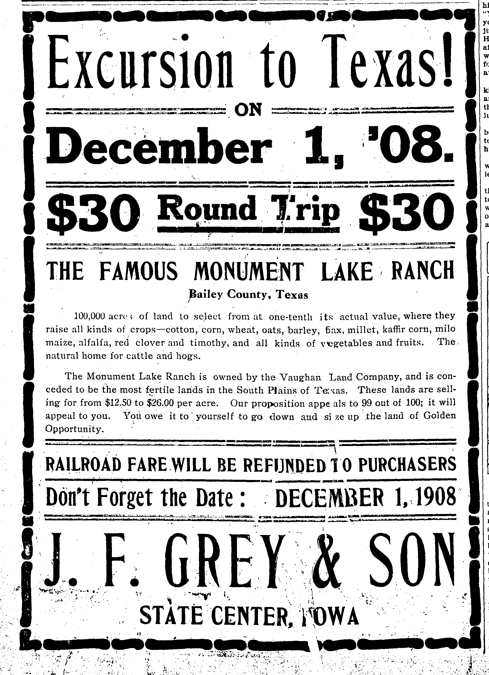
Courtesy of the State Center Enterprise (State Center, Iowa), November 19, 1908
Land values typically varied in accordance with the proximity to a railroad, and this trend did not elude Vaughan's effort in Bailey County. When the Atchison, Topeka, and Santa Fe Railroad reached Lubbock in 1911, the goal of establishing a route connecting the two major branches of the ATSF system emerged as a tangible reality with the projected completion of a line between Lubbock and Texico-Farwell in 1913. With the relatively flat and uninhabited plain that existed on the Llano Estacado between the points, the ATSF chose a direct route between Lubbock and Texico-Farwell that featured no major deviations from a relatively straight line. This route entirely bypassed Virginia City and Vaughan's land scheme by 20 miles and effectively ended any hope of connecting the land and its incoming settlers to a reliable railroad.
Excursions to the Vaughan land continued through 1912 and into 1913, but dire conditions hindered Vaughan as he attempted to salvage the beleaguered effort. This is most evident in a small collection of correspondence between Vaughan and an independent land agent whose own struggle coincided with Vaughan's. The Vaughan Land Company contracted with several independent agents in various states throughout its short history, including Beth Bowers in Dubuque, Iowa, H.M. Hickock in Bloomington, Wisconsin, and J.F. Grey and Son of State Center, Iowa, among others. The J.C. Whicker Land Company of Lafayette, Indiana, whose correspondence offers the only known internal correspondence from Vaughan, became the most prolific of these independent agencies. James Campbell ( J.C.) Whicker acted as the eastern sales manager for the Vaughan Land Company beginning in 1911 bringing with him a large number of sales from Illinois and Indiana.84 Whicker worked for Vaughan during the waning years of Vaughan's effort selling land in Bailey County and also in nearby Hockley and Crosby counties. Whicker entered a period of financial decline by 1913, while Vaughan had mostly abandoned his Bailey County efforts and transitioned to more lucrative land in counties east. In a November 14, 1914, letter, Whicker revealed his struggles noting the poor quality of his credit and general lack of adequate sales. Whicker further relates his sales had dropped due to Vaughan not paying promissory notes and mortgages on land he acquired. News of this permeated through the region and affected Whicker's associated sales.85 Whicker made several trips to West Texas between 1911 and 1914 before eventually settling in Littlefield, Texas, where he eventually became the field manager for the Yellow House Land Company in later years.86
With these struggles, it is no surprise that Vaughan and several associates received foreclosure notices in May 1915 on a large number of sections in Bailey County. Named in the foreclosure suit appeared another Waterloo man, Fayette F. McElhinney, who served as the president of the Black Hawk National Bank in Waterloo. At its founding, the Vaughan Land Company headquartered in the Syndicate Building in downtown Waterloo, but the company relocated to McElhinney's Black Hawk Bank Building in 1911.87 McElhinney and Vaughan previously worked together at the Waterloo Carriage Company and likely formed a business relationship there.88 The foreclosure notice listing the Bailey County property indicates McElhinney invested in the Vaughan Land Company and backed the loans Vaughan utilized to acquire land in Bailey County.89 Bailey County deed records further indicate McElhinney held a warranty deed on land in the county as early as 1911.90 In early 1914, McElhinney became insolvent in his other business interests, likely affecting the Vaughan Land Company's abilities to operate further.91 Vaughan himself faced another lawsuit in September 1913 by H.H. Hanna of Waterloo for failing to pay down a $21,687 loan note granted in 1911.92 Hanna visited the Vaughan lands in 1912 and spoke favorably of Bailey County, likely indicating Hanna possessed an interest in the land there.93 Vaughan's other connections included Farwell banker and eventual Parmer County Judge James Darlington Hamlin. Judge Hamlin lobbied Vaughan's attention to save the Farwell Bank from insolvency during this time. Hamlin convinced Vaughan to put forth a mortgage in which he offered as security his subsidiary cattle operation in Bailey County to save the bank. According to Hamlin, Vaughan's efforts saved the Farwell Bank but further diminished Vaughan's financial status when it already appeared tenuous.94
Vaughan conducted an excursion to Bailey County in June 1913, but the emerging struggle of the effort became more evident to settlers in Bailey County as financial and climatological conditions worsened. Between 1907 and 1909, the South Plains climate enabled the production of abundant crops that attracted northern settlers hoping to exploit an advantageous climate that produced consistent crops. The South Plains experienced a drought that rendered dryland farming temporarily untenable during the following years. Updates in Roosevelt County, New Mexico, newspapers became more infrequent as the settlement dwindled. William Pulver (W.P.) Soash's land colonization operation in Howard County experienced a similar downturn during the same years that resulted in a similar failure of Soash's company and townsites.95 The Vaughan Land Company began losing prominent figures beginning in 1913. Most notably, L.W. Fiscus, the manager of the Vaughan Auto and Transportation Company, returned to Iowa in July 1913 as the company began selling the cars necessary to transport prospectors. Hotel manager J.H. Rigdon closed the Virginia City hotel at the same time.96
Many of the colonists returned to their home states and left scattered and sparse remnants of their presence. Junked farm equipment remained on the land until World War II when scrap metal became a valuable asset to the war effort. Settler Carey M. Kisor's corner posts remained on the land in the vicinity of Virginia City for many years.97 Arch, New Mexico, officials purchased the school building at an auction in 1916 and transported it seventeen miles to the nearby community.98 Maple Wilson relocated the Virginia City hotel to his land in Bailey County where it served as a residence for many years. The Muleshoe Heritage Center relocated and restored the hotel in the mid-2000s, and it remains a centerpiece of the museum.99 The old railroad grade can still be seen in some locations in Bailey County near the site of Virginia City and at various points in the sandhills of Bailey County.
Almost mythic, Virginia City continued to be a periodic topic among Bailey County citizens through the remainder of the 20th century and into the 21st. Occasional newspaper articles in the Muleshoe Journal and Bailey County Journal recalled stories of the failed effort to colonize that part of the county. A 1924 article satirized the community:
Virginia City has a great future. It has the longest and widest streets in this territory. It is furnished by water from Lake Monument, a natural lake that travelers used and is on the old road and immigrant trail to Mexico. Billy the Kid once sojourned upon a time in the cliff near the lake. All remember he was a terror in New Mexico… The city was once destroyed by Santa Anna in the year 1832. There are some who think it was Quanah Parker and his tribe of Indians in later years. The railroad right of way was built by J.H. Heeley, who managed the Rock Island Construction Company and original plans were to build from Dawson coal mines via Virginia [City] to Montezuma, Mexico.100
Although mostly satirical, the article does possess some intrinsic accuracy. Virginia City did exist on the banks of Monument Lake, and the lake did support immigrants on their route to and from New Mexico. Billy the Kid and his gang may have camped at the cliffs near the lake as they actively marauded in the region with a known camp at Las Portales, which is 25 miles from Monument Lake and on the same trail to Fort Sumner, New Mexico.101 Early cattlemen in the vicinity such as Presley Barrett Penney recalled encountering suspicious individuals at the cave, but the identities of these mysterious characters never came to light.102
After his Bailey County foray, Vaughan continued selling land for a short period in Hockley and Crosby counties, but those efforts shuttered quickly. M.C. Vaughan retreated to Waterloo where he died in 1926 at the age of fifty-seven. His obituary lauded his Texas land company along with his local initiatives in the Waterloo area.103 Like many efforts to colonize the Texas South Plains, Vaughan's goal remained unrealized mainly due to factors beyond his control. Deteriorating climatological conditions rendered promises of yearly lush crops impossible to attain and left many of the settlers incapable of paying for the land they farmed. Although irrigated farms existed in nearby land to the north and northwest, the land south of the sandhills in Bailey County did not feature accessible water even from drilled wells. Portales enjoyed a land rush in 1909 and subsequent growth when drilling efforts located abundant water near the city, but this result eluded Vaughan and rendered farming difficult in dry years.104 As early as 1885, the Blum Land Company attempted to drill wells on their land, but they also failed to locate water in significant abundance.105 Bailey County residents exuded skepticism regarding the colonization efforts. An early Bailey County historian interviewed residents who anecdotally recalled that "suckers" comprised the principal harvest during the county's formative years, referring specifically to the ill-informed prospectors lured by the Vaughan Land Company.106 More than a century following its brief existence, Virginia City and the Vaughan Land Company's effort to colonize Bailey County had little effect on the region's long-term growth or history. Few, if any, settlers who populated Vaughan's land stayed after the company's demise, and there are no remnants of settlement other than the restored hotel at the Muleshoe Heritage Center and a few segments of the old railroad grade still visible. A lonely Texas Historical Commission roadside plaque marks the location of Virginia City as a reminder of its brief existence.
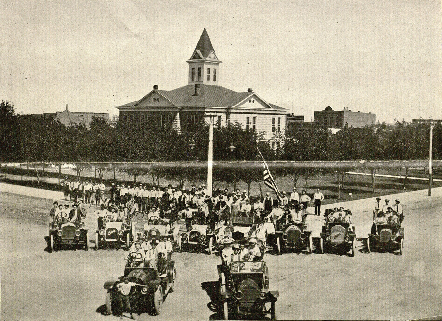
Courtesy of Beinecke Library, Yale University