Land Grant Map of Texas (1836)
This 1836 map of Texas shows the territory during its waning moments as part of Mexico. Most notable about this map is its illustrative representation of the various empresario grants that were organized to lure settlers to Texas from the United States. Although not entirely accurate, the map does offer a historically significant view of Texas during its most historic period. Used in conjunction with other maps in the collection, researchers can utilize this 1836 map to study how Texas was charted by cartographers as far back as the 17th century.
Our map collection is continuously expanding and has accumulated many maps that are either one-of-a-kind or exceptionally rare. The Southwest Collection contains a variety of cartographic resources that can be used by patrons to visually understand the topics that they are researching.
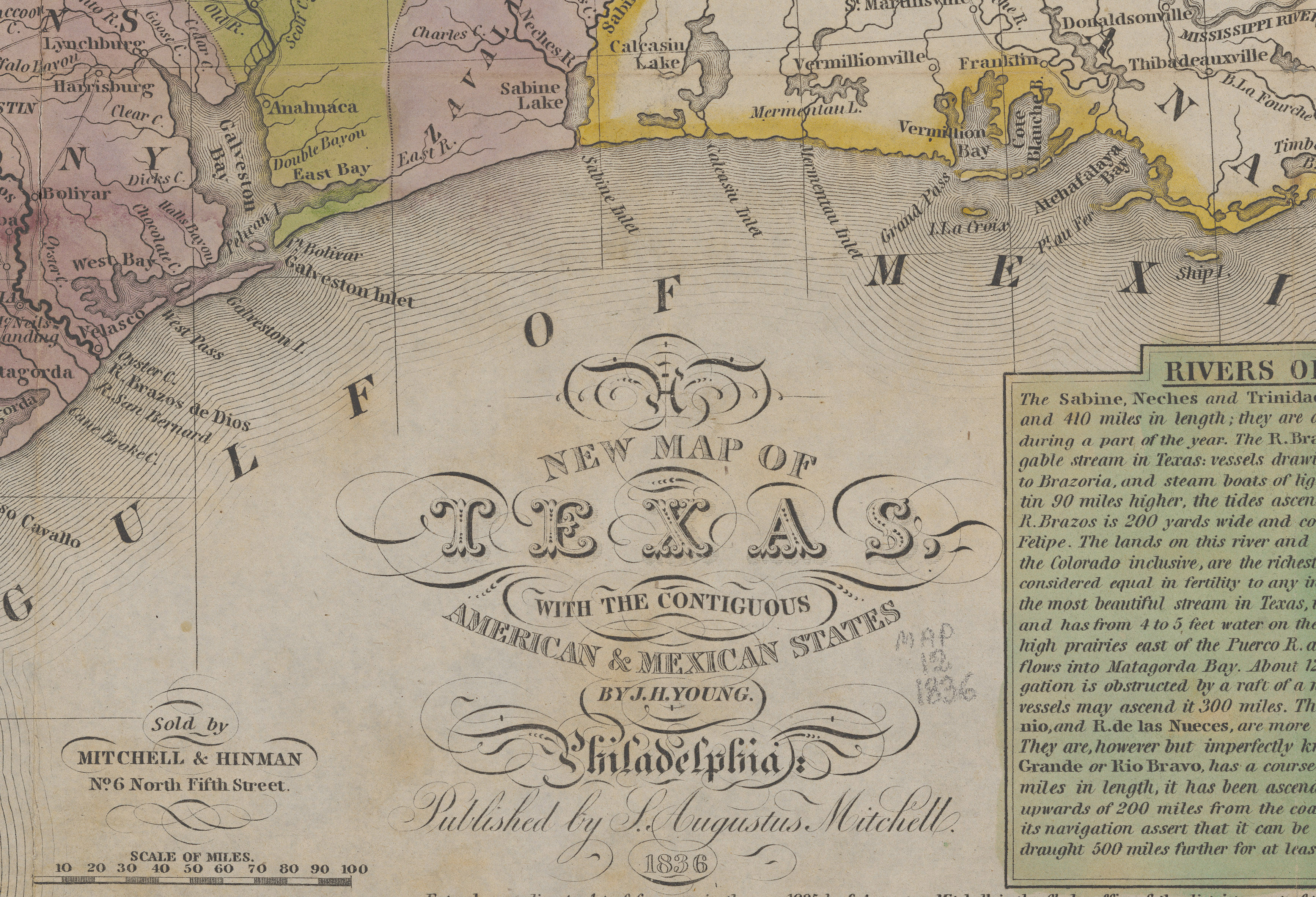
Southwest Collection/Special Collections Library, Texas Tech University
German-Texas Civil War Newspaper (1864)
During the height of the Civil War, supply lines for many Confederate states, including Texas, were cut off or greatly reduced. This 1864 issue of Der Texas Democrat is unique for being printed on a segment of wallpaper, undoubtedly due to the lack of a reliable source of paper. While not the only newspaper to resort to such techniques, this one offers a unique perspective on history by exemplifying the struggles people underwent during times of hardship.
Beginning with microfilm production in the 1950s, we have been at the forefront of reformatting newspapers for long-term preservation. Advanced digital preservation now allows geographically remote patrons to access digital versions of these newspapers online with the added benefit of reducing the potential for damage to the physical copies. This newspaper, along with more than 175,000 issues of other Texas and West Texas volumes, is available online through the Southwest Collection’s digital archive.
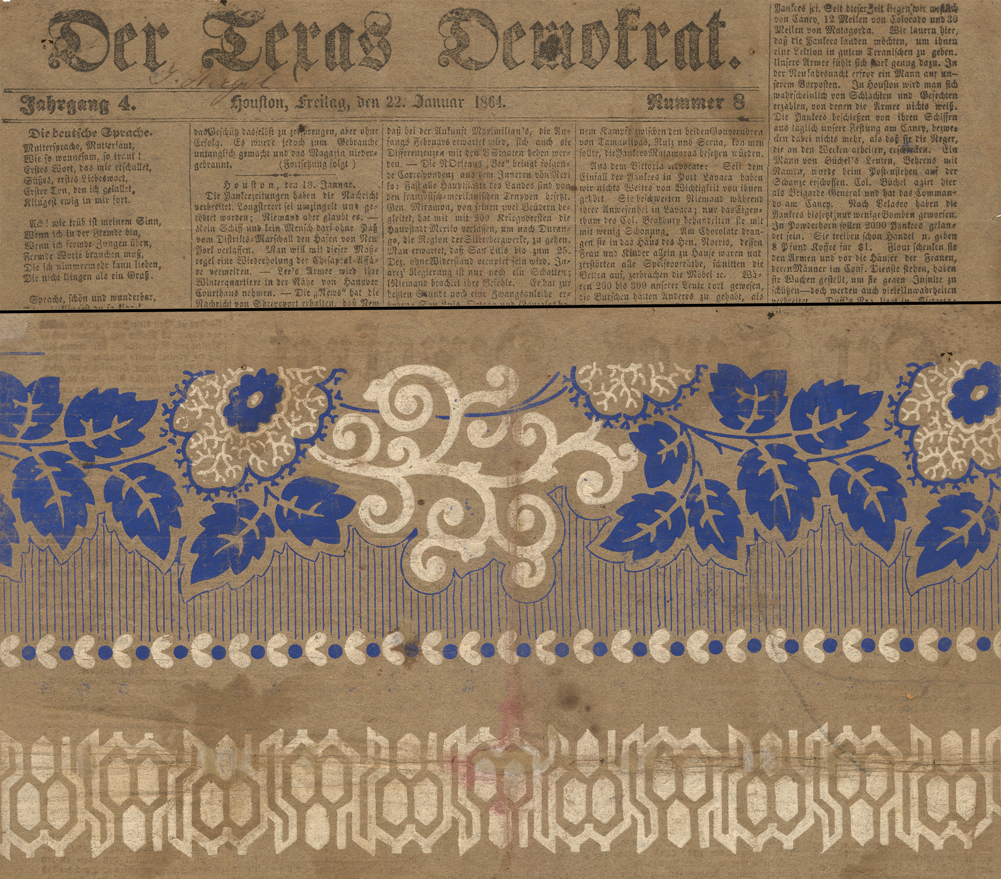
Southwest Collection/Special Collections Library, Texas Tech University