The intent of this article is to identify and discuss key locations relevant to the utmost source, or headwaters, of the Missouri River. Attempts to locate the headwaters of North America's longest river date back to the Lewis and Clark Expedition of the early-nineteenth century. Progressive advances in technology and an enhanced understanding of river systems has changed the way rivers are understood. Perhaps the most detailed evaluation of the Missouri River's headwaters occurred in the mid-1890s by Jacob Vandenburg Brower, a Minnesota attorney and semi-professional geologist and surveyor, who identified a point in the Centennial Mountains of southwestern Montana as the headwaters of the river. At this site Brower took photographs and buried a commemorative copper plate, but there is significant ambiguity regarding exactly where this site exists. Since Brower's visit, there has been only one recorded attempt to locate this site and the copper plate. Using Brower's published research in conjunction with the notes of the modern attempt, I seek to clarify Brower's research and detail his attempts to find the utmost source of the Missouri River and Brower's copper plate.1
The majesty of the Missouri River and its impact on the history of the West is unmistakable. The watershed alone extends from St. Louis to just beyond the Canadian border, and its encompassing tributaries reach a large portion of the central and northern plains and Rocky Mountains. North America's longest river emanates from an elevated canyon nestled in the Centennial Mountains and Centennial Valley of southwestern Montana and meanders through miles of mountains, forests, and plains to discharge ultimately into the Gulf of Mexico more than 3,700 miles downstream. However, as it stands today, the Missouri River officially begins at the confluence of the three rivers that come together at the Missouri Headwaters State Park near Three Forks, Montana: the Jefferson River, the Madison River, and the Gallatin River. While these three rivers have carved unique histories of their own, this junction is not the true origin of the waters of the mighty Missouri. A questionably justified decision made more than 200 years ago during the identification of these watercourses truncated the seminal portion of the river.
It is customary for the longest watercourse of a major river system to retain its proper name as far as its source. The longest of these three upper rivers, the Jefferson River, and its longest continuous upstream streambed adds more than 250 miles to the length of the Missouri River system past the Three Forks junction. For this reason, some consider it an error for the Jefferson River not to retain Missouri River's name throughout its course and the courses of its longest upper tributaries, the Beaverhead River, the Red Rock River, Red Rock Creek, and Hell Roaring Creek. In contrast, the Mississippi River retains its name from the Gulf of Mexico to its source at Lake Itasca. Likewise, the Columbia River retains its name from its source at Columbia Lake in British Columbia to where it empties into the Pacific Ocean at Cape Disappointment. For the sake of this article, I evaluate the Missouri River as if it continues farther upstream than where the Madison, the Gallatin, and the Jefferson merge.
Lewis and Clark's Attempt to Find the Source
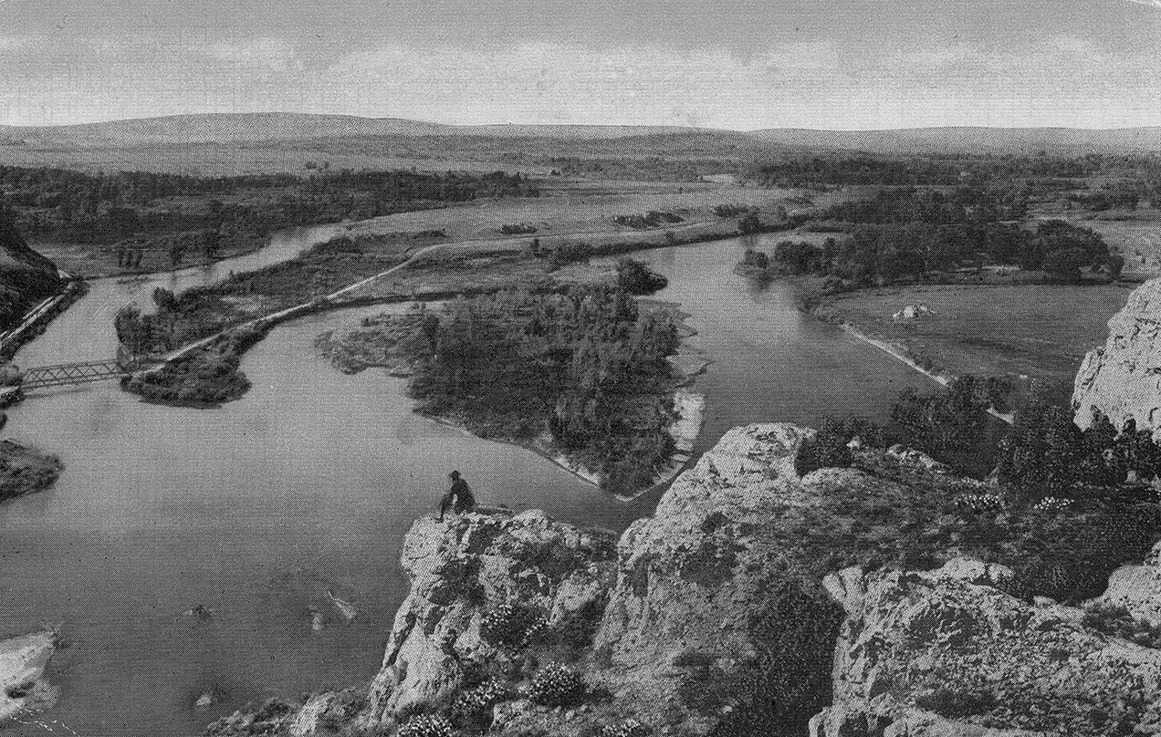
Today, anyone can trace the route of the Missouri by using a program as simple and widely available as Google Earth. Tracing the river in the nineteenth century required much greater effort and precision. Most Americans today have a cursory understanding of the Lewis and Clark Expedition and the expansion of the United States westward in the early part of the nineteenth century, but one of the goals of the exploration was to study the Missouri River. In 1803, President Thomas Jefferson ordered Meriwether Lewis and William Clark's Corps of Discovery to measure the extent of the Missouri River by following it as far as practicable to a point at which they could cross the Continental Divide on their way to the Pacific Ocean.2 Finding this point to cross the divide, in their mind, meant attempting to find where the river began. The expedition religiously followed the Missouri, often traversing and describing many of the tributaries that discharged into it. Traveling through what is now southwestern Montana in August 1805, Lewis and a separate scouting party diverged from the main group and followed the Beaverhead River upstream to where the Red Rock River and Horse Prairie Creek merge to form the Beaverhead River.
Public domain
Winter was drawing near, and it was integral to the success of the expedition that they cross the Continental Divide before major snows clogged negotiable passes and hindered their progress. Instead of following the Red Rock River, now known as the longer of the two tributaries, Lewis chose instead to follow Horse Prairie Creek and then Trail Creek to its source near modern Lemhi Pass and summarily designated that location as the source of the Missouri. This location still stands today as an important historical site for being the location where the Corps of Discovery crossed the Continental Divide, but Lewis erroneously designated it as the "most distant fountain of the waters of the mighty Missouri."3 It is understandable that Lewis, with the Corps' unwavering goal to cross the Continental Divide and reach the Pacific Ocean in mind, rushed to the conclusion that this location was the source of the Missouri River. It was rather unlikely that he could have fathomed that the opposite streambed, the Red Rock River and its longest tributaries, were an additional 50 miles in length when compared to the stream he had followed.4 For almost a century, the claim that Lemhi Pass was the source of the Missouri went unchallenged. Perhaps this lack of inquisitiveness was due to the existence of a deep reverence for the Lewis and Clark Expedition that still permeates the history of the region. However, during the closing decade of the nineteenth century and as southwestern Montana became less remote and more accessible with the advent of rail transportation into the region, another explorer with experience evaluating rivers began his journey to establish his opinion.
Brower's Attempt to Find the Source
That explorer, an often-overlooked Minnesota attorney and pioneering surveyor named Jacob Vandenberg Brower, embarked on a mission to determine the true utmost source of the Missouri River during the waning years of the nineteenth century. In his 1896 book titled The Missouri River and Its Utmost Source, he defended the results of his seemingly successful search with numerous photographs, maps, and observations to support his theory that Meriwether Lewis mistakenly proclaimed Lemhi Pass as the source. Brower, having previously settled a contentious debate regarding the source of the Mississippi River at Lake Itasca in north central Minnesota between 1889 and 1891, set out in the summer of 1895 to southwestern Montana to examine the different tributaries of the upper Missouri. On August 2, 1895, after travelling six days from his home in Minnesota, Brower arrived at Lima, Montana, aboard a Union Pacific train to commence his examinations. The town of Lima sits just outside the western edge of the Centennial Valley along the Red Rock River, and it offered Brower the perfect location from which to base his studies.5
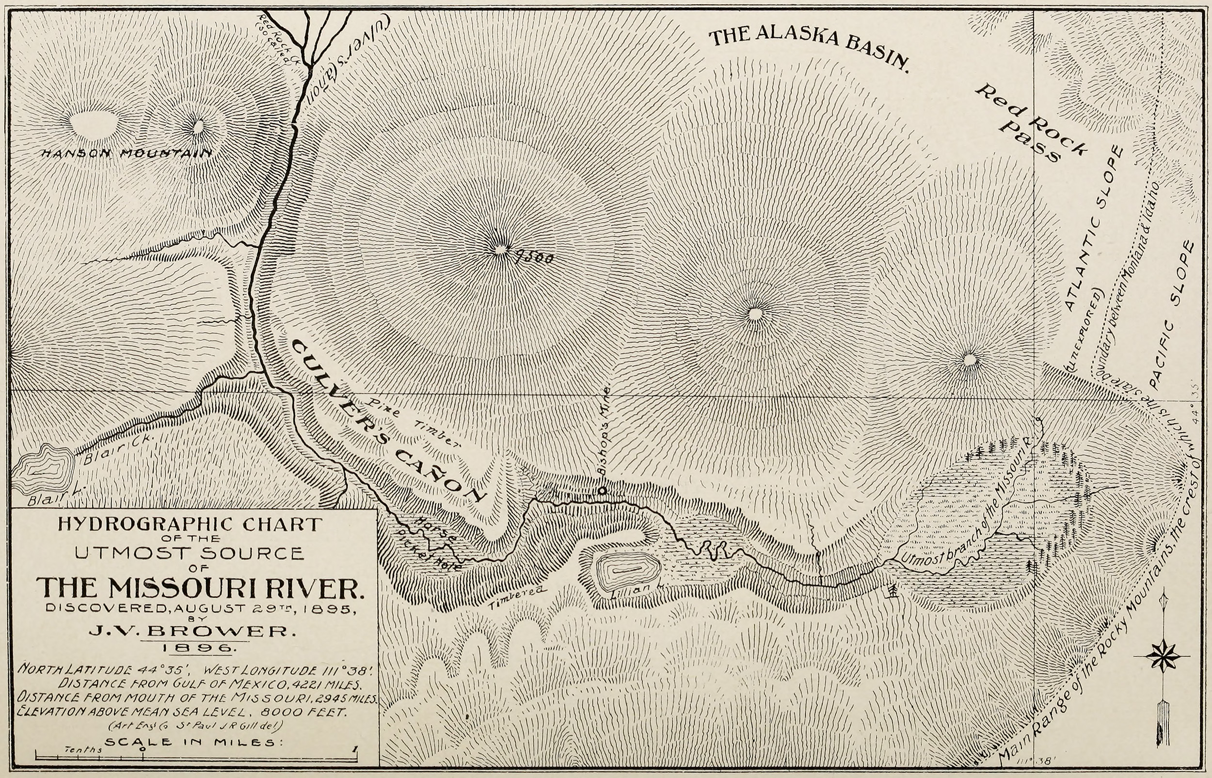
The Centennial Valley is an east-west oriented valley that contains numerous creeks, springs, and lakes that all feed into either Hell Roaring Creek, Red Rock Creek, or the Red Rock River, and thus ultimately
From Brower, The Missouri River and Its Utmost Source (1896). Public domain
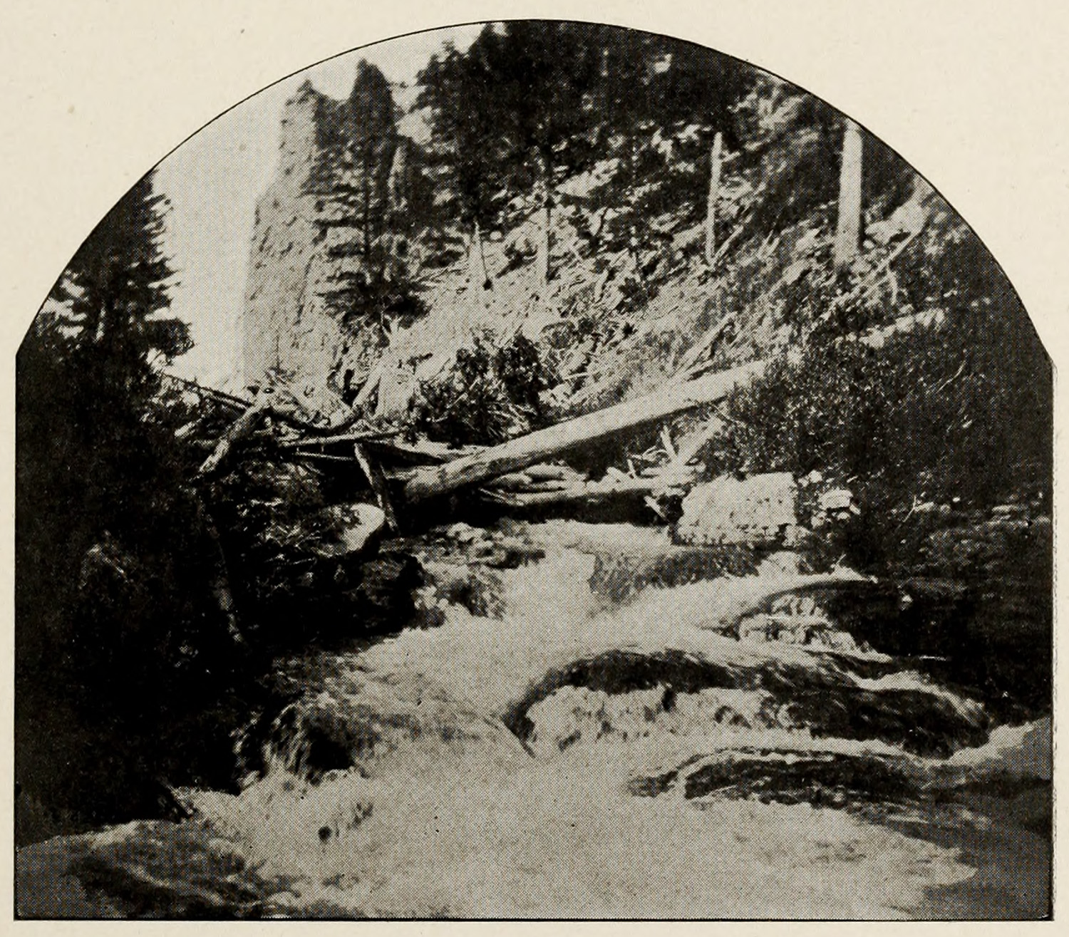
into the Beaverhead, Jefferson, and Missouri rivers, depending on the location within the valley. Beginning on August 3, 1895, Brower, accompanied by Isaac Jaques of Lima and William N. Culver of the Centennial Valley, traversed the valley from its western point eastward toward the Alaska Basin, a feature at the extreme east end of the valley. After two days of investigation in the Alaska Basin and Centennial Valley, Brower discovered a likely candidate for the utmost source of the Missouri River. Culver's Canyon, a previously unnamed canyon named after Brower's assistant and one of the valley's most prominent ranchers, is a narrow defile positioned at the south end of the Alaska Basin.6 After tracing several streambeds in the valley and basin to their source, Brower discovered that the principle stream flowing through the valley as the Red Rock River emanated from this canyon. Brower briefly examined the lower extremity of Culver's Canyon on August 5, but he was unable to penetrate farther than the lower reaches of the canyon due to a high accumulation of downed trees and other debris blocking the stream bed.7
From Brower, The Missouri River and Its Utmost Source (1896). Public domain
To confirm his suspicions that Culver's Canyon was indeed the furthest source of the river, Brower descended from Culver's Canyon and the Centennial Valley to explore some of the other tributaries of the Missouri. During much of the month of August 1895, he visited Three Forks, Montana, the city nearest the confluence of the Madison, Gallatin, and Jefferson rivers, to gather measurements for those rivers. He also visited locations near the Big Hole River, another contender for the origin of the Missouri. Although he was confident that he was correct about Culver's Canyon, the only way to ensure his theory was correct required him to measure all possible opposing streams.8
The length of the Madison River from where it joins the Gallatin and the Jefferson near Three Forks, Montana, to its utmost source at the head of Gibbon Creek is approximately 210 miles.910 Conversely, the Gallatin River from the same point to its utmost source is approximately 120 miles.11 In comparison, the Jefferson River branch extends approximately 240 miles to its utmost source in Culver's Canyon. Brower understood that the Jefferson River was likely the longest branch, but the biggest problem he encountered was the measurement of the two major Jefferson River tributaries, the Big Hole River, and the Beaverhead River. Brower's aim was to carefully examine the Big Hole River, for its discharge appeared to be greater than that of the Beaverhead River. Brower noted that irrigation for agriculture in 1890s southwestern Montana affected the drainage discharge of the Beaverhead River, but that it did not necessarily affect the overall length of the river.12 The Beaverhead River,13 along with its longest upper tributaries, the Red Rock River, Red Rock Creek, and Hell Roaring Creek, is approximately 159 miles in length.14 The Big Hole River, which retains the Big Hole River name throughout its entire discharge, is approximately 153 miles in length.15 By the end of August, Brower returned to the Alaska Basin and the Centennial Valley armed with sufficient knowledge about the upper Missouri to begin an earnest evaluation of where it truly began. He immediately planned a trip up Culver's Canyon and again employed the assistance of Isaac Jaques and William Culver. Brower's intention for this trip was clear: continue his efforts to identify and evaluate the utmost source. To avoid the obstruction encountered on his inaugural expedition up Culver's Canyon, Brower, Jaques, and Culver bypassed the blockage on August 29 by ascending nearby Hanson Mountain to skirt around the cluster of trees downed in the river and rejoined the canyon and creek past the hindrance. After skirting around the blockage and leaving Jaques with the horses at an established camp, Brower and Culver pressed onward and soon encountered a small mountain lake that lies a short distance from the main stem of Hell Roaring Creek. This lake, named Lillian Lake in honor of Culver's wife, is a prominent water feature in the canyon that supplies discharge water for the creek. Few, if any, individuals prior to Brower had traversed this canyon with the goal of accurately describing it, and up to the mid-1890s there was no written record detailing its characteristics or the names of prominent features. Brower and Culver had almost complete autonomy to name many of the features they encountered, many of which retain those names today.
Lillian Lake marked the last reliably known location Brower described before arriving at the location he designated as the utmost source. A short distance later, the party arrived at a broadening of the canyon, a "Hole in the Mountains," that signified the end of their search. The Hole in the Mountains received its name due to the bowl-like nature of the mountains to the east that appear to be missing a sizable portion. Brower intended to name this feature in a similar manner to other features he named, but no official name for this location beyond his initial label followed. The reason for this is not clear. On arriving at this point, Brower and Culver buried a copper plate, recorded elevation measurements, marked a faulted rock with their initials, and took 20 photographs. After spending a rather short amount of time at this location and with seemingly little fanfare, Brower and Culver descended back to the Alaska Basin and the Centennial Valley with the accomplishment of being the first individuals to identify the canyon as containing the Missouri River's source.16 Brower ultimately returned to Minnesota to compile his research into a book that detailed his initial findings. This book was published in May 1896.17
Brower would return to the Centennial Valley in the late spring of 1896, but he did not return to study the location he designated as the source of the Missouri, choosing instead to focus on mapping the other geographical and hydrological features of the valley and
From Brower, The Missouri River and Its Utmost Source (1896). Public domain
canyon. On three separate expeditions up Culver's Canyon in mid-June 1896, Brower and his assistants built stone monuments along the state line border between Montana and Idaho and named many geographic features in honor of residents of the Centennial Valley. Brower details his movements throughout the Centennial Valley, the Alaska Basin, and Culver's Canyon, but he does not state that he again visited the Hole in the Mountains, a location that figured prominently in his first study of the canyon. He denotes visits to Lillian Lake, Hanson Mountain, and Horse Picket Hole, which are all sites he visited in 1895. He climbed the highest mountains in the canyon, some of which are over 10,000 feet in elevation, but his notes mention neither a return visit to the Hole in the Mountains nor any other location associated with the source of the Missouri.
It is possible that weather conditions and high snow levels present in the canyon dissuaded him from investigating the source further. Brower's 1895 trip notes do not suggest that he struggled with snow at any point on his trek to the Hole in the Mountains canyon. On three separate expeditions up Culver's
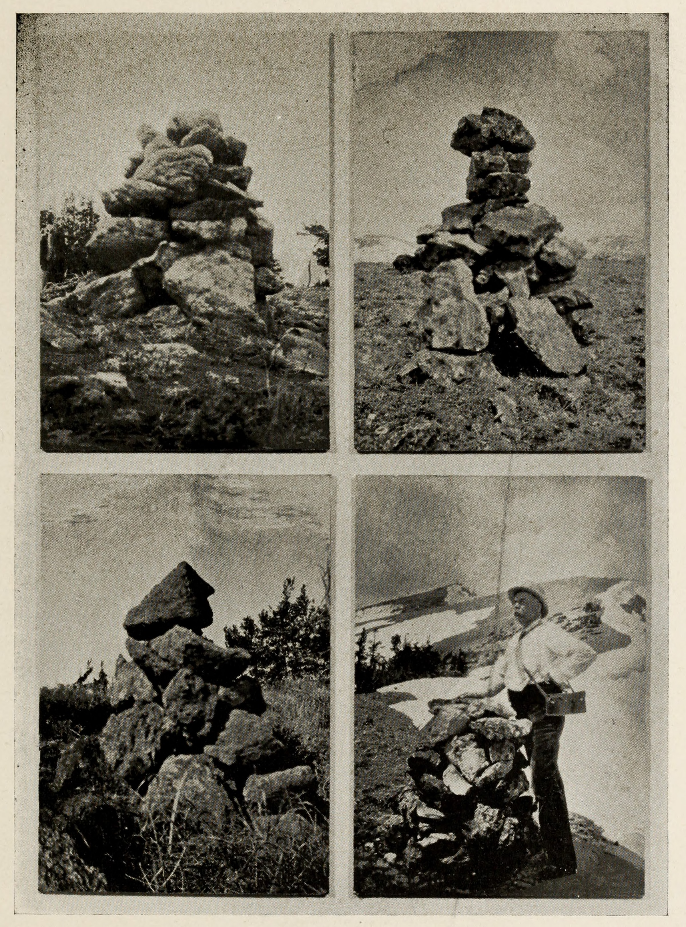
From Brower, The Missouri River and Its Utmost Source (1896). Public domain
source, but his notes from 1896 tell a different story. Brower had to alter his exploratory routes through the canyon many times to avoid difficult and dangerous conditions created because of snow in the canyon. Snow inundates the canyon from fall through late spring or early summer each year, making it unlikely that enhanced study of the source was possible.18
Another more lucrative endeavor occupied Brower's thoughts during his trip to the canyon in the summer of 1896. Mere days following Brower's visit to the Hole in the Mountains in August 1895, a group of three individuals found gold in the canyon and recorded their discovery by filing a prospecting claim.19 Not to be outdone, Brower and his assistants spent a significant amount of time exploring that potential on Brower's return the next year in 1896. On Brower's third trip up Culver's Canyon at the end of June 1896, he, William Culver, and James Blair, another valley resident, spent one day studying and collecting gold-bearing quartz. On his final trip up the canyon, the team completed their studies regarding gold in the canyon, and later the group filed a claim of their own in the canyon. On his return to Minnesota in the late summer of 1896, Brower anxiously corresponded with William Culver and James Blair about the results of tests he conducted on the quartz and soil gathered from near the small vein.20 Although Brower does not spend much time discussing the gold in the Centennial Mountains in his book, it is clear through his correspondence that it marked yet another alluring feature of the region he was studying.21
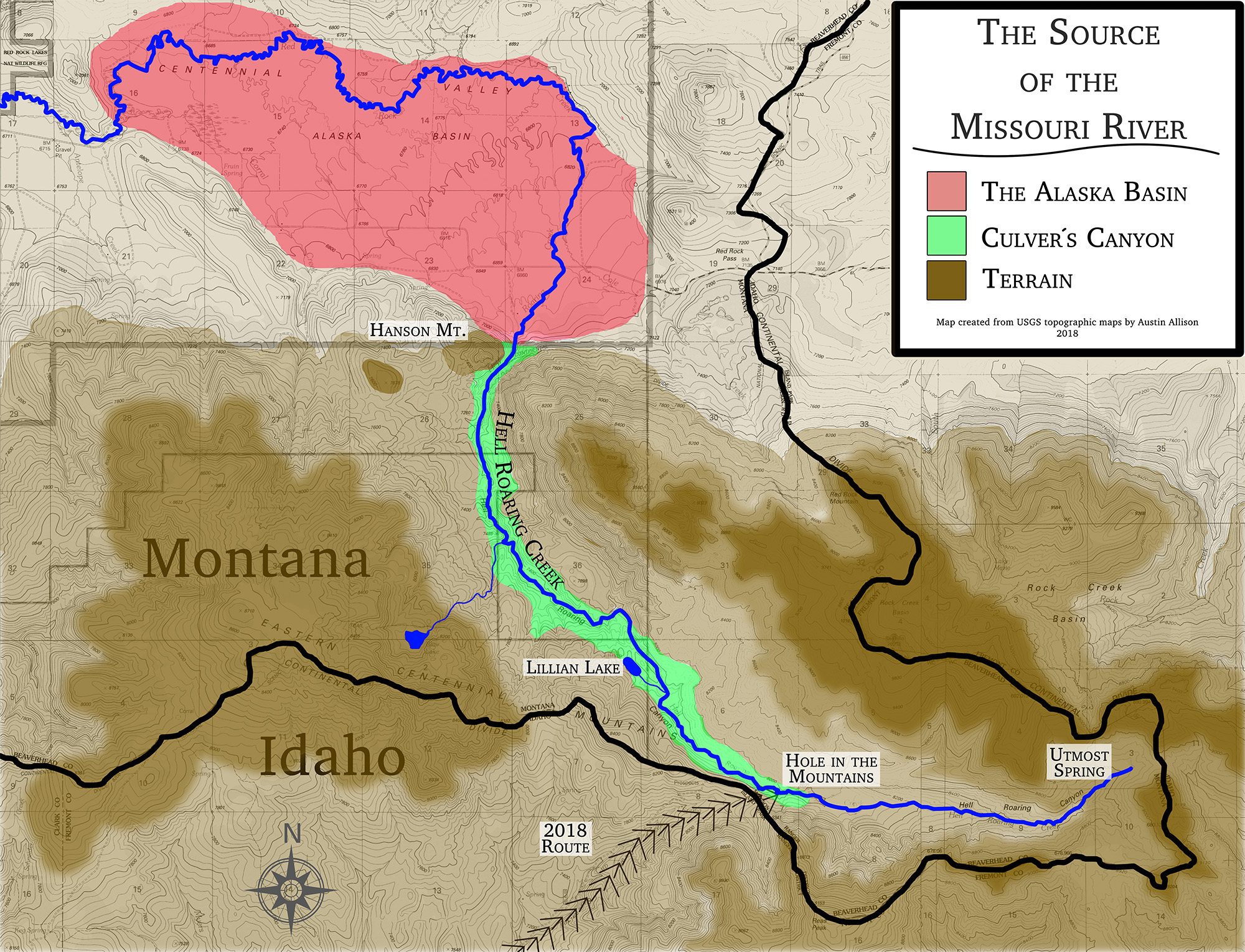
Created by the author from topographical maps published by the United States Geological Survey
In December 1896, a devastating fire destroyed the entire collection of research Brower accumulated from the two expeditions to the Centennial Valley and Mountains.22 Thankfully, the first edition of his book reached publication seven months prior to the fire, and the second edition was on press at the time of the fire.23 Even more thankfully, modern researchers have access to the bulk of Brower's research through the two separately published volumes and their digitized surrogates.
Evaluating Brower's Research
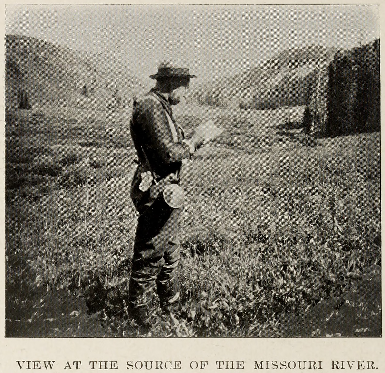
Determining the precise location of Brower's utmost source has proven to be more difficult than is readily apparent. Brower was not particularly specific in his description of where he was when he proclaimed to have found the source of the Missouri River. One of the glaring inconsistencies with Brower's logic is the terminology he used to discuss the site, and more specifically the difference in his writings between the terms "utmost source" and the "utmost spring." Brower copiously uses the term "utmost source" to denote the site he located, but he only uses the term "utmost spring" once in reference to a letter he received from Lillian Culver, the wife of William N. Culver. "Utmost source" is found at least 22 times in his book, and this point can be reliably linked to the location that he named The Hole in the Mountains. This theory might be difficult to prove but for descriptive photograph captions in his book. Two photographs, each taken with either Brower or Culver in the foreground, were captured at the same location with the same geographical features present in the background. The photograph of Brower (Fig. 4) is captioned "View at the Source of the Missouri River," while the photograph of Culver (Fig. 7) is captioned "The Hole in the Mountains."24
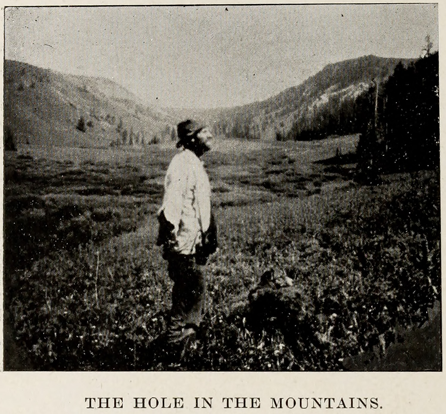
From Brower, The Missouri River and Its Utmost Source (1896). Public domain
It is reasonable to question why he chose to use "source" many times but only use "spring" once. Following Brower's first visit of 1895, Lillian Culver explored Culver's Canyon and visited Brower's Hole in the Mountains site in September 1895, but she did not stop there. In correspondence to Brower, she describes that she pressed further "to see just where the creek headed." After continuing 3 miles farther up Hell Roaring Creek, Mrs. Culver came on a picturesque spring issuing "from under a large black rock on the side of the mountain." Culver marked this site by carving her initials in the rock and burying a strewn horseshoe along with a tin plate. Brower bestows on Culver the honor of being the first woman at the utmost source of the Missouri proclaiming, "no lady has preceded Mrs. Culver at the utmost source of the Missouri." Here he uses the term "source," but in the paragraph immediately preceding, he writes that Culver "marked the utmost spring of the Missouri upon the side of the mountain very near the Idaho state boundary."25 This was the only time in either of his books that he used the term utmost spring. It is appropriate to suggest that Culver's utmost spring location and Brower's Hole in the Mountain are two entirely different sites based on the way Brower describes each.
Finding Brower's Hole in the Mountains, and thus his utmost source, would seem to be as simple
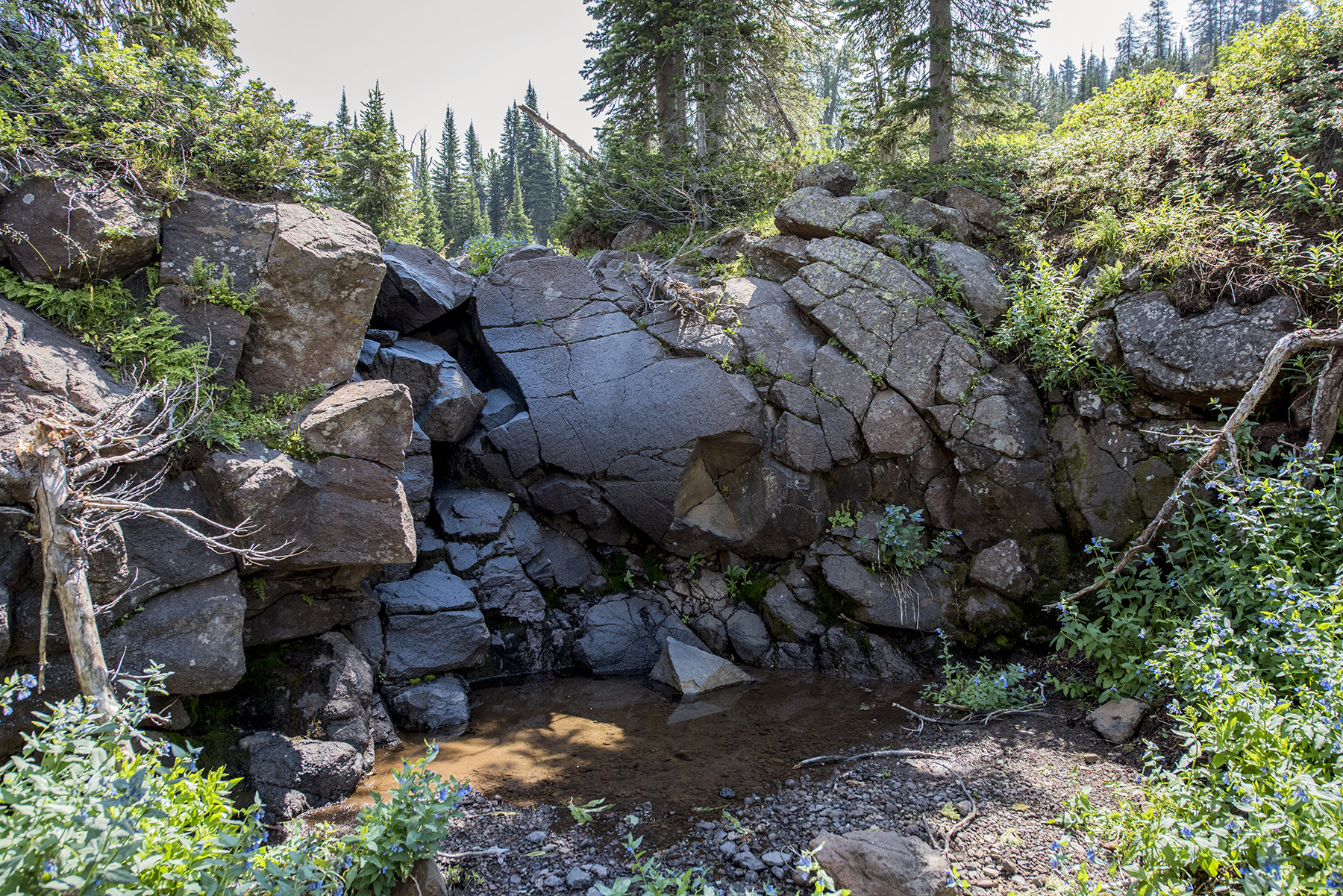
Photograph courtesy of the author
as matching Brower's photographs with a modern image taken at the same location. Although Culver's Canyon is a relatively small locality, being only approximately 2,500 acres in area, matching Brower's location poses numerous issues. First, Brower's site is upstream and eastward from Lillian Lake, but there was no statement from him to estimate how much farther he went. Hell Roaring Creek flows an additional 3.5 miles past Lillian Lake up the canyon, and Brower potentially could have taken his photographs anywhere in that span. One of the few specific remarks that he does make about the source is that it lies at about 8,000 feet in elevation.26 Second, Culver's Canyon, even today, is remote. The nearest community, Island Park, Idaho, is 11 miles away, and the nearest paved road is more than 4 miles away. Reaching Culver's Canyon to do photographic matching at different locations in the canyon would be difficult, for an individual could spend days walking the canyon trying to match the photographs.
Modern Pursuits to Find Brower's Source
The Lewis and Clark Trail Heritage Foundation (LCTHF) Headwaters Chapter remains the only known organization to attempt to locate Brower's utmost source. Like the author, the discovery of Brower's book spurred this group's interest in visiting the utmost source and perhaps being able to locate the buried copper plate. John Montague, a former president of the LCTHF, hiked up Hell Roaring Creek and Culver's Canyon in 1989, and visited the spring location that matches Lillian Culver's description. At the site, Montague discovered a mound of rocks that had been built to commemorate the spring. Under this monument, hikers and
Photograph courtesy of the author
explorers in years past deposited a glass jar so that others could register their names as having visited the headwaters of the Missouri. Montague deposited his name in the jar and descended from the elevated spot to recount his story to his fellow LCTHF members. The next summer Donald Nell, another member of the LCTHF, organized a 15-person team to hike up Hell Roaring Creek and Culver's Canyon from the Alaska Basin in the same manner that Brower had done 100 years prior. The anticipated goal of this expedition was to "locate Brower's copper plate." The team was unsuccessful due to a member falling and breaking an ankle, but they did visit the spring and mound monument to add their names to the jar. Members of the LCTHF documented their trip in an article that appeared in the November 2002 issue of We Proceeded On, the official publication of the LCTHF.27
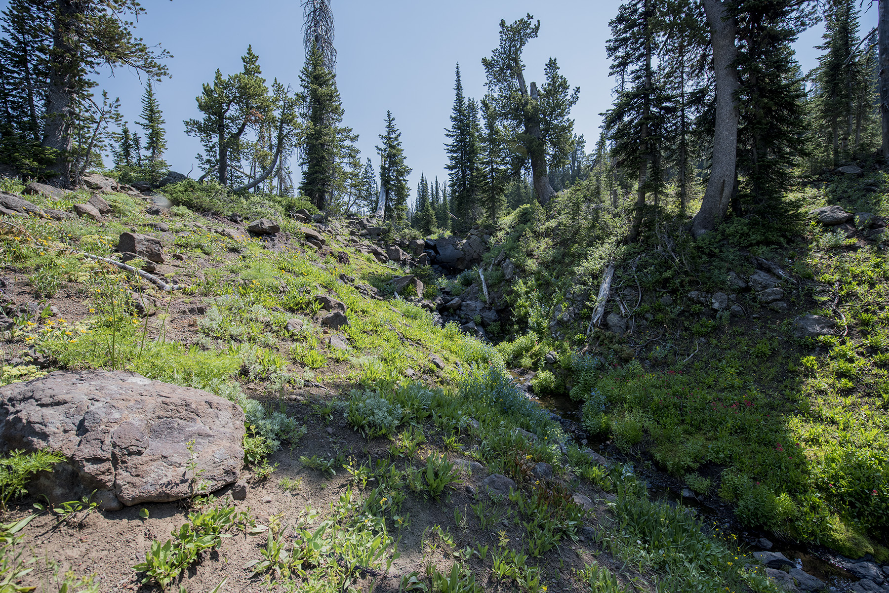
During the summers of 2016 and 2017, the author traveled from West Texas to visit the spring with a similar quest to find Brower's copper plate, making significant use of the LCTHF's article to guide his route. Brower's book did not figure prominently in the preparations for these trips. It was assumed, based on the LCTHF article, that Brower identified the spring at the head of Culver's Canyon and Hell Roaring Creek as the utmost source of the Missouri and buried his plate there. The LCTHF and their writings were confident in that location. This contention was reasonably justified because the water of the Missouri River begins at that spring, at least during the summer months when the canyon is free from snow. Although photography and drone videography captured on this trip provided the author with valuable visual resources for further study, the trips of 2016 and 2017 were unsuccessful in locating the copper plate at this location.
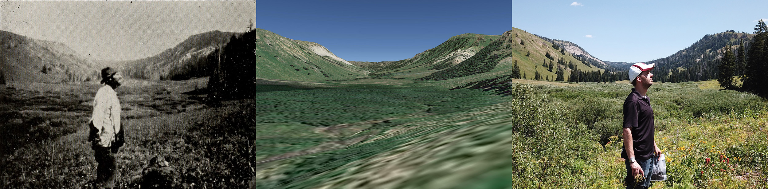
Hiking several miles both ways in two consecutive years without locating the copper plate was somewhat demoralizing, but the enticing goal of locating Brower's copper plate compelled continued research and exploration. Was it possible that the author and LCTHF focused erroneously on the spring location rather than pursuing and clarifying the location of Brower's Hole in the Mountains? Following the author's unsuccessful 2017 trip, it became evident from the evaluation of Brower's book that his Hole in the Mountains source and the utmost spring at the head of Hell Roaring Creek were not the same location. The pictures in Brower's book did not match the topography of the area surrounding Brower's spring based on both ground and aerial photography gathered in 2016 and 2017. The spring is at a relatively narrow, claustrophobic location; Brower's photographs at the Hole in the Mountains portray a more expansive, open setting. Furthermore, the elevation reading for the spring was too high compared to what Brower recorded. Brower specifically notes that the source resided at almost exactly 8,000 feet; the utmost spring, as noted by the LCTHF and USGS maps, is at roughly 8,800 feet.28 While it is impossible to know where exactly Brower buried his copper plate in 1895, it is likely that the LCTHF members and the author walked directly past the plate at Brower's Hole in the Mountains in favor of pursuing the plate at the spring location that Lillian Culver described. Could computer-generated topography and terrain assist in clarifying these locations? (Fig. 10)
Left-hand photograph from Brower, The Missouri River and Its Utmost Source (1896). Public domain. Other illustrations courtesy of the author
Google Earth offers a unique feature that allows users to view 3D renderings of terrain at specific locations. This feature uses known geographic data for elevations to generate representations that offer a rather accurate vantage point. Even with this Google Earth feature, specifically locating Brower's location would take time. It was the author's intention to revisit Culver's Canyon in August 2018 armed with an approximate starting location based on matching Brower's two Hole in the Mountains photographs with Google Earth's terrain representation of the area. Any individual who views Brower's photographs can ascertain certain features of the topography present. The most obvious feature is the mountain formations in the background. The mountain on the right possesses a rather flat, butte-like top with nearly identical edges that lead gradually to the top. The mountains on the left appear more rounded. Brower himself is standing on a gently sloping hill. Culver's Canyon is oriented mostly in an east-west direction with the creek flowing from east to west. So, based on the orientation of the rising elevation on the right side of the foreground, Brower took his pictures while he was standing near the south side of the canyon. After many hours of trial and error digitally scouring the canyon with Google Earth, the author found an approximate location for Brower's site 1 mile upstream from Lillian Lake but more than 2 miles downstream from the spring.
Possessing this knowledge, a return trip to Culver's Canyon ensued during August 2018. Rather than ascending Culver's Canyon by entering it from the Alaska Basin at its northern terminus like Brower and the LCTHF, the author entered the canyon from the south. The shortest route to the canyon and the predicted location of the Hole in the Mountains is via a National Forest road in Idaho that approaches the canyon from the south. From here, it is possible to park on this road within 3 miles of the Hole in the Mountains. This lies in contrast to the Alaska Basin route that requires a nearly 5-mile hike through much rougher terrain. The accuracy of Google Earth's artificial terrain led the author to within a handful of feet of the orientation of the terrain features present in Brower's photographs. An intense search for the copper plate ensued, but it once again eluded capture despite the increasing likelihood that it was buried somewhere near this location and not at the spring.
The number of reasons for not finding the copper plate is endless. Modern metal detectors, although advanced and capable, can only penetrate the ground so deep; an object deposited in 1895 could reside more than a foot under the surface, lying just outside the reliable penetration distance of most consumer metal detectors. Ground penetrating radar could be useful in this terrain, but such technology is cost prohibitive for such a project. The topography of that locality has changed in the century since the copper plate was buried, and a rough evaluation and exploration of the south side of Hell Roaring Creek at this site shows a significant amount of erosion where Brower's photographs were taken. A 2,000 square foot span of the bank of Hell Roaring Creek is completely gone and eroded. The copper plate may have been displaced a distance down the creek during the past century and may be under an ever-increasing amount of silt and eroded soil deposited by the creek every year. There is also the possibility that it was uncovered by a similar erosive episode and found by an unwitting passerby.
The accuracy of Google Earth's artificial terrain was paramount to the success of finding Brower's Hole in the Mountains site. Without it, an individual could spend an inconceivable amount of time walking Culver's Canyon trying to find Brower's copper plate. With it, the relative search area decreased significantly. Being at this hallowed location, the canyon where water for the mightiest river in North America originates is inspiring and humbling. The United States' most storied explorers sought this location, but it exists today in relative obscurity.
The Source: Wrapped Up
Brower deserves the bulk of the credit for exploring and describing this section of the United States. His work still stands as the most comprehensive study of the utmost regions of the Missouri River, and many of the data, photographs, and descriptions are still relevant to researchers. Other credit must be assigned, however. Despite Brower's adamant sleuthing, he likely was not the individual who identified where the Missouri River truly begins. That distinction belongs to Lillian Culver who continued up Hell Roaring Creek and Culver's Canyon past Brower's Hole in the Mountains to the utmost spring of the Missouri. Brower himself acknowledges this fact in his book. She vividly described the location from where the water of the Missouri issued; the location that Brower sought but did not adequately pursue. She made the effort to designate the utmost spring by going the extra 2 miles in pursuit of where the water began. It is not clear why Brower chose to stop at the Hole in the Mountains, a site that does not remotely resemble the beginning of a watercourse. Brower's blunder of settling for the Hole in the Mountains as the source of the Missouri River is unfortunate, for it casts the Missouri River system shorter than it is and leaves an entire section of the river relatively undescribed as compared to the river immediately below it. Thankfully, Lillian Culver had the audacity and forethought to seek the true source.
Water from the source in Culver's Canyon flows more than 3,700 miles before emptying into the Gulf of Mexico. It is unfortunate that this site is not a celebrated heritage location like Lake Itasca at the headwaters of the Mississippi River or even Three Forks State Park. The spring location remains unnamed today despite being a prominent location within the Missouri River system. The United States Geological Survey and its maps do not even recognize that there is a spring at the head of Culver's Canyon, a spring that emits water that ultimately flows thousands of miles into the Gulf of Mexico. Thousands of springs, both great and forgettable, are named and marked along this system, but its foremost spring remains unaccounted for and unrecognized. Modern scholars have unofficially labeled this location "Brower's Spring," despite the likelihood that he may have never seen it. A Wikipedia entry, to which the author contributed, exists for Brower's Spring, but, like many Wikipedia entries, it lacks critical information about its discovery and its significance. Brower is a worthy candidate to lend his name to this location due to his extensive and unsurpassed investigative research into Culver's Canyon, the Alaska Basin, and the Centennial Valley, but there is no conclusive evidence to suggest he visited the true source.
From Brower, The Missouri River and Its Utmost Source (1896). Public domain
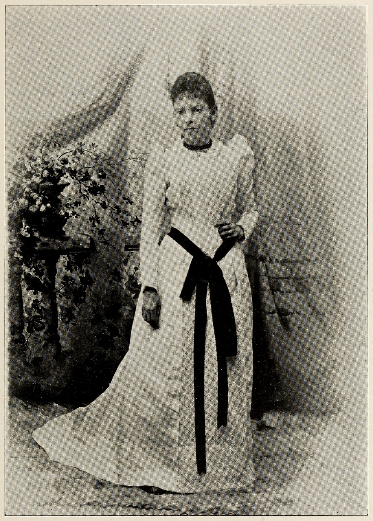
Lillian Culver, a preeminent citizen and explorer of the Centennial Valley during its early years of settlement, shared with Brower the fortitude and willingness to face adverse conditions to seek a goal. Her efforts, not only aiding Brower, but blazing a trail of her own to discover the utmost spring cannot be overlooked. Perhaps the utmost spring at the head of Hell Roaring Creek should bear the name of Lillian Culver to honor her role in its discovery? Her impact and relevance to the history of southwestern Montana and to the Centennial Valley persist to this day. Culver settled in the Centennial Valley in 1886, and her footprint for being a constant advocate for the wellbeing of the valley is hard to dismiss. A brief search of Dillon, Montana's digitized historic newspaper archives generates dozens of entries that Lillian Culver authored with news specifically related to the Centennial Valley. One of her ancestors noted that she "kept the Centennial Valley in the news."29 A large portion of what is known today about the cultural heritage of the Centennial Valley's early history exists due to the efforts of Culver. Some of Culver's personal correspondence are preserved today at Montana State University's Merrill G. Burlingame Special Collections Library. It is difficult to overlook her contributions to the valley with the knowledge that she marked the true utmost source of North America's longest and most storied river.